Islam Md Yachin, Nasher N M Refat, Karim K H Razimul, Rashid Kazi Jihadur
Center for Environmental and Geographic Information Services (CEGIS), Dhaka, Bangladesh.
Faculty of Life and Earth Sciences, Jagannath University, Dhaka, Bangladesh.
Heliyon. 2023 Apr 25;9(5):e15617. doi: 10.1016/j.heliyon.2023.e15617. eCollection 2023 May.
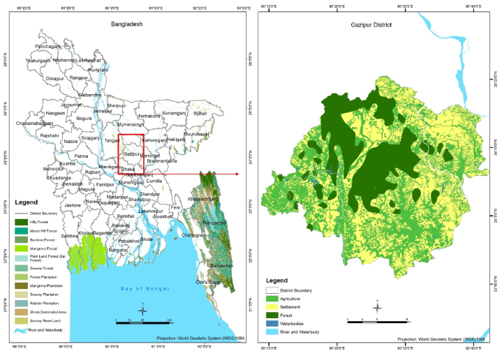
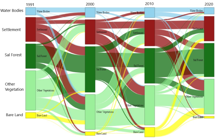
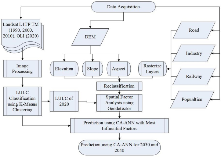
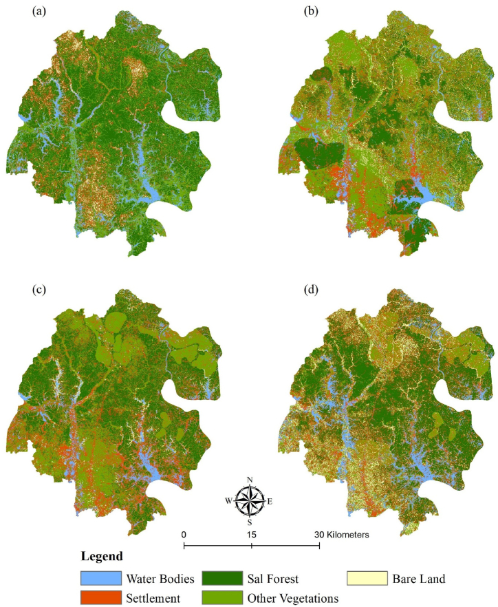
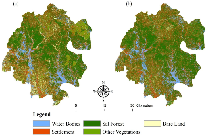
The conversion of forest cover due to anthropogenic activities is of great concern in the Madhupur Sal Forest in Bangladesh. This study explored the land use changes in the Sal Forest area from 1991 to 2020, with the prediction of 2030 and 2040. This study examined and analyzed the changes in five land use classes viz., waterbodies, settlement, Sal Forest, other vegetation, and bare land, and predict those classes using Cellular Automated Artificial Neural Network (CA-ANN) model. The Sankey diagram was employed to represent the change percentage of Land Use and Land Cover (LULC). The LULC for 1991, 2000, 2010, and 2020 derived from Landsat TM and Landsat OLI images, were used to predict the periods of 2030 and 2040. During the last 30 years, the Sal Forest area decreased by 23.35%, whereas the settlement and bare land area increased by 107.19% and 160.89%. The greatest loss of the Sal Forest was observed from 1991 to 2000 by 46.20%. At the same period of time the settlements were increased by 92.68% indicating the encroachment of settlement in the Sal Forest area. The Sankey diagram revealed a major conversion was found between other vegetation and the Sal Forest area. There was a vis-à-vis between other vegetation and the Sal Forest area from 1991 to 2000 and from 2000 to 2010. Interestingly, there was no conversation of the Sal Forest area to other land use from 2010 to 2020, and the prediction showed that the Sal Forest area will be increased by 52.02% in 2040. The preservation and increment of the Sal Forest area suggested strong governmental policy implementation to preserve the forest.
由于人为活动导致的森林覆盖变化在孟加拉国的马杜布尔盐林备受关注。本研究探讨了1991年至2020年盐林地区的土地利用变化,并对2030年和2040年进行了预测。本研究考察并分析了水体、聚落、盐林、其他植被和裸地这五种土地利用类型的变化,并使用细胞自动人工神经网络(CA-ANN)模型对这些类型进行预测。桑基图用于表示土地利用和土地覆盖(LULC)的变化百分比。利用1991年、2000年、2010年和2020年来自陆地卫星TM和陆地卫星OLI图像的LULC来预测2030年和2040年的情况。在过去30年中,盐林面积减少了23.35%,而聚落和裸地面积分别增加了107.19%和160.89%。1991年至2000年期间盐林损失最为严重,达46.20%。同一时期,聚落增加了92.68%,这表明盐林地区受到了聚落的侵占。桑基图显示,其他植被和盐林地区之间发生了重大转变。1991年至2000年以及2000年至2010年期间,其他植被和盐林地区之间存在着一种相对关系。有趣的是,2010年至2020年期间盐林面积没有转变为其他土地利用类型,并且预测显示2040年盐林面积将增加52.02%。盐林面积的保护和增加表明需要政府强力实施政策来保护森林。