Department of Public Health, Institute of Tropical Medicine, Antwerpen, Belgium
Population and Health Impact Surveillance Group, KEMRI-Wellcome Trust Research Programme, Nairobi, Kenya.
BMJ Glob Health. 2023 Oct;8(10). doi: 10.1136/bmjgh-2023-013471.
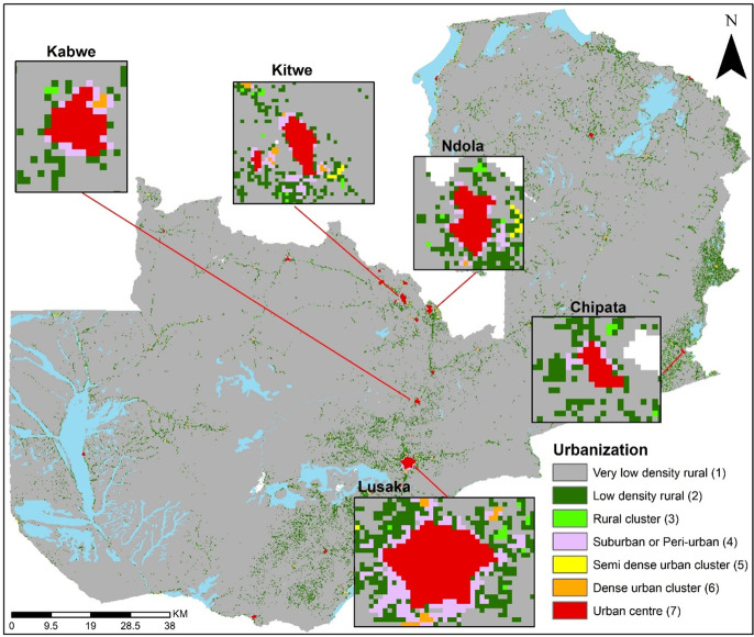
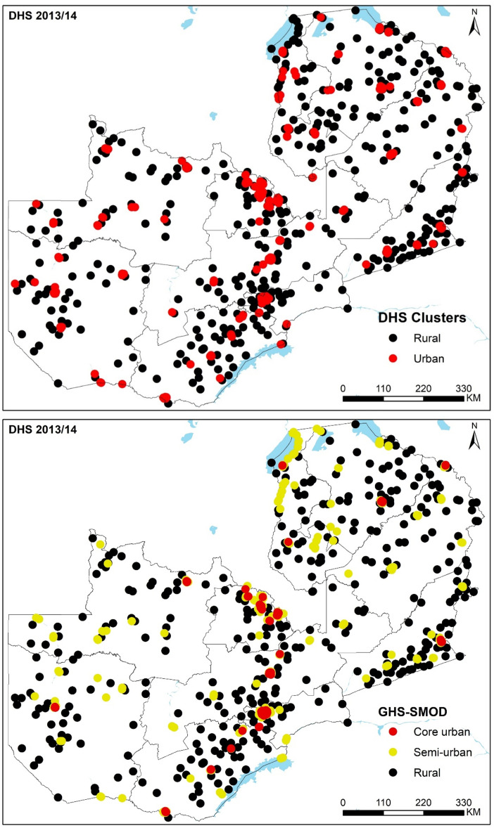
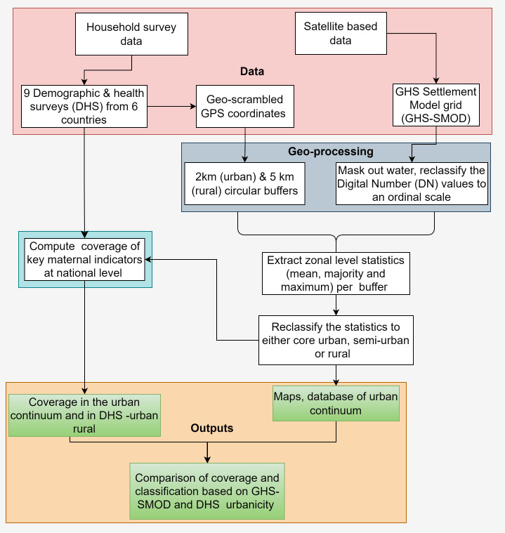
The demographic, ecological and socioeconomic changes associated with urbanisation are linked to changes in disease incidence, health service provision and mortality. These effects are heterogeneous between and within urban areas, yet without a clear definition of what constitutes an 'urban' area, their measurement and comparison are constrained. The definitions used vary between countries and over time hindering analyses of the relationship between urbanisation and health outcomes, evaluation of policy actions and results in uncertainties in estimated differences. While a binary urban-rural designation fails to capture the complexities of the urban-rural continuum, satellite data augmented with models of population density and built-up areas offer an opportunity to develop an objective, comparable and continuous measure which captures urbanisation gradient at high spatial resolution. We examine the urban gradient within the context of population health. We compare the categorisation of urban and rural areas (defined by national statistical offices) used in household surveys in sub-Saharan Africa (SSA) to an urban-rural gradient derived from augmented satellite data within a geospatial framework. Using nine Demographic and Health Surveys (DHS) conducted between 2005 and 2019 in six SSA countries, we then assess the extent of misalignment between urbanicity based on DHS categorisation compared with a satellite-derived measure, while discussing the implications on the coverage of key maternal health indicators. The proposed indicator provides a useful supplement to country-specific urbanicity definitions and reveals new health dynamics along the rural-urban gradient. Satellite-derived urbanicity measures will need frequent updates to align with years when household surveys are conducted.
城市化带来的人口、生态和社会经济变化与疾病发病率、卫生服务提供和死亡率的变化有关。这些影响在城市地区之间和内部是不同的,但由于没有明确界定什么是“城市”地区,因此它们的测量和比较受到限制。各国和不同时期使用的定义各不相同,这阻碍了对城市化与健康结果之间关系的分析、对政策行动的评估以及对估计差异的不确定性。虽然城乡二元划分未能捕捉到城乡连续体的复杂性,但结合人口密度模型和建成区的卫星数据为开发客观、可比和连续的衡量标准提供了机会,该标准可以以高空间分辨率捕捉城市化梯度。我们在人口健康的背景下研究城市梯度。我们将撒哈拉以南非洲(SSA)家庭调查中使用的城乡分类(由国家统计局定义)与地理空间框架内增强卫星数据得出的城乡梯度进行比较。然后,我们使用六个 SSA 国家在 2005 年至 2019 年期间进行的九次人口与健康调查(DHS),评估基于 DHS 分类的城市化程度与卫星衍生衡量标准之间的不匹配程度,同时讨论对关键孕产妇健康指标覆盖范围的影响。拟议的指标为特定国家的城市化定义提供了有用的补充,并揭示了农村-城市梯度上的新健康动态。卫星衍生的城市化衡量标准需要经常更新,以适应进行家庭调查的年份。