Jutla Antarpreet, Aldaach Haidar, Billian Hannah, Akanda Ali, Huq Anwar, Colwell Rita
Department of Civil and Environmental Engineering, West Virginia University, Morgantown, WV, United States of America.
Department of Civil and Environmental Engineering, University of Rhode Island, Kingston, RI, United States of America.
PLoS One. 2015 Sep 29;10(9):e0137828. doi: 10.1371/journal.pone.0137828. eCollection 2015.
Cholera, an infectious diarrheal disease, has been shown to be associated with large scale hydroclimatic processes. The sudden and sporadic occurrence of epidemic cholera is linked with high mortality rates, in part, due to uncertainty in timing and location of outbreaks. Improved understanding of the relationship between pathogenic abundance and climatic processes allows prediction of disease outbreak to be an achievable goal. In this study, we show association of large scale hydroclimatic processes with the cholera epidemic in Zimbabwe reported to have begun in Chitungwiza, a city in Mashonaland East province, in August, 2008.
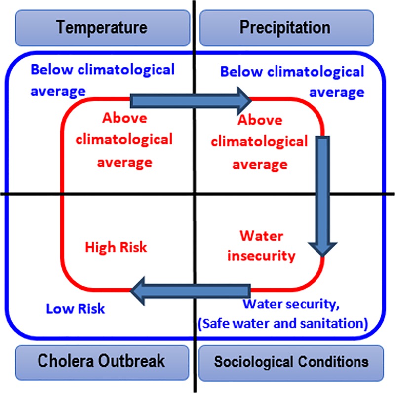
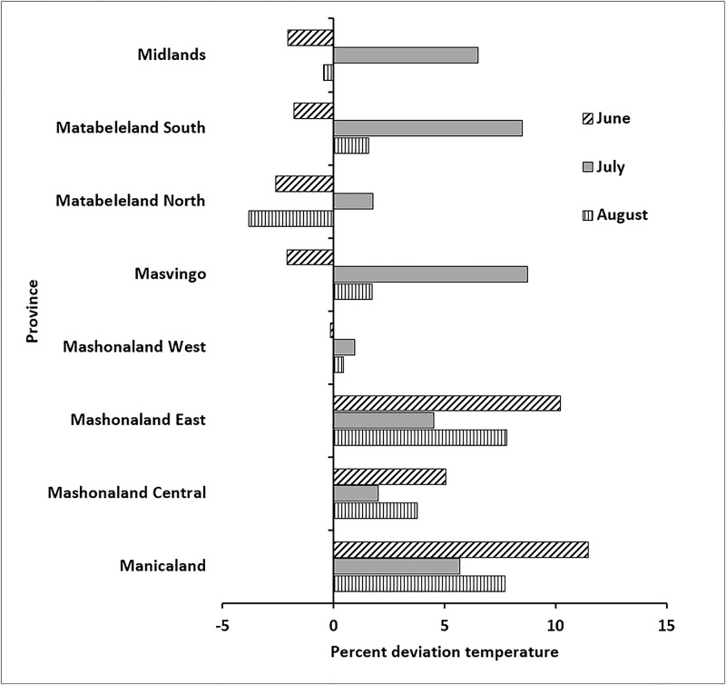
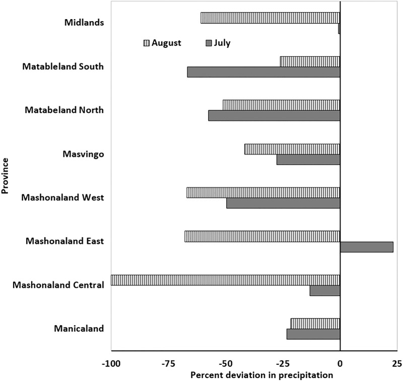
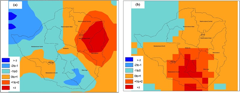
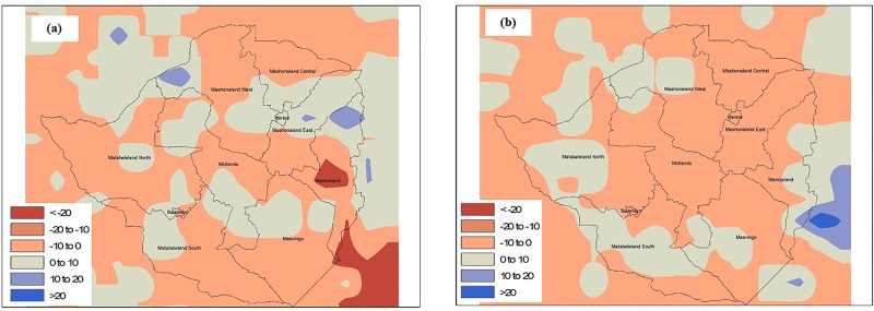
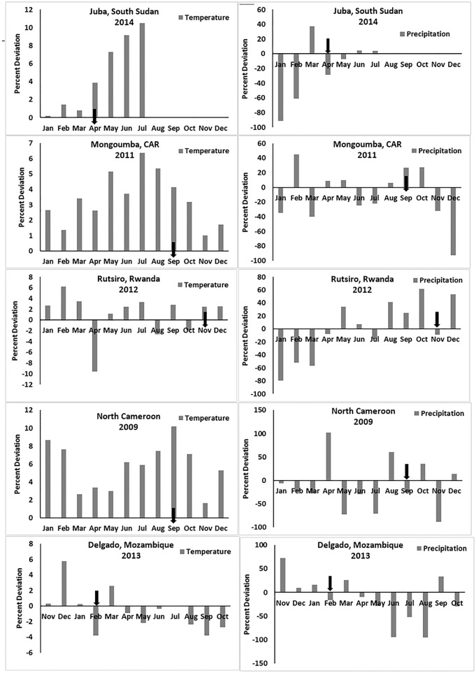
Climatic factors in the region were found to be associated with triggering cholera outbreak and are shown to be related to anomalies of temperature and precipitation, validating the hypothesis that poor conditions of sanitation, coupled with elevated temperatures, and followed by heavy rainfall can initiate outbreaks of cholera. Spatial estimation by satellite of precipitation and global gridded air temperature captured sensitivities in hydroclimatic conditions that permitted identification of the location in the region where the disease outbreak began.
Satellite derived hydroclimatic processes can be used to capture environmental conditions related to epidemic cholera, as occurred in Zimbabwe, thereby providing an early warning system. Since cholera cannot be eradicated because the causative agent, Vibrio cholerae, is autochthonous to the aquatic environment, prediction of conditions favorable for its growth and estimation of risks of triggering the disease in a given population can be used to alert responders, potentially decreasing infection and saving lives.
霍乱是一种传染性腹泻疾病,已被证明与大规模水文气候过程有关。霍乱疫情的突然和零星爆发与高死亡率相关,部分原因是疫情爆发时间和地点的不确定性。更好地理解病原体丰度与气候过程之间的关系,使得疾病爆发预测成为一个可实现的目标。在本研究中,我们展示了大规模水文气候过程与据报道于2008年8月在东马绍纳兰省的奇通圭扎市开始的津巴布韦霍乱疫情之间的关联。
该地区的气候因素被发现与引发霍乱疫情有关,并且显示与温度和降水异常有关,证实了卫生条件差、气温升高,随后暴雨可能引发霍乱疫情的假设。通过卫星对降水和全球网格化气温进行空间估计,捕捉到了水文气候条件中的敏感性,从而能够确定该地区疾病爆发开始的位置。
卫星衍生的水文气候过程可用于捕捉与津巴布韦出现的霍乱疫情相关的环境条件,从而提供一个早期预警系统。由于霍乱无法根除,因为病原体霍乱弧菌是水生环境中的本土细菌,预测有利于其生长的条件以及估计在特定人群中引发该疾病的风险,可用于提醒应对者,有可能减少感染并挽救生命。