Kabir Muhammad, Hameed Shoaib, Ali Hussain, Bosso Luciano, Din Jaffar Ud, Bischof Richard, Redpath Steve, Nawaz Muhammad Ali
Carnivore Conservation Lab, Department of Animal Sciences, Quaid-i-Azam University, Islamabad, Pakistan.
Wildlife Research Unit, Dipartimento di Agraria, Università degli Studi di Napoli Federico II, Via Universita n. 100, Portici, Napoli, Italy.
PLoS One. 2017 Nov 9;12(11):e0187027. doi: 10.1371/journal.pone.0187027. eCollection 2017.
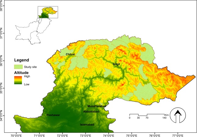
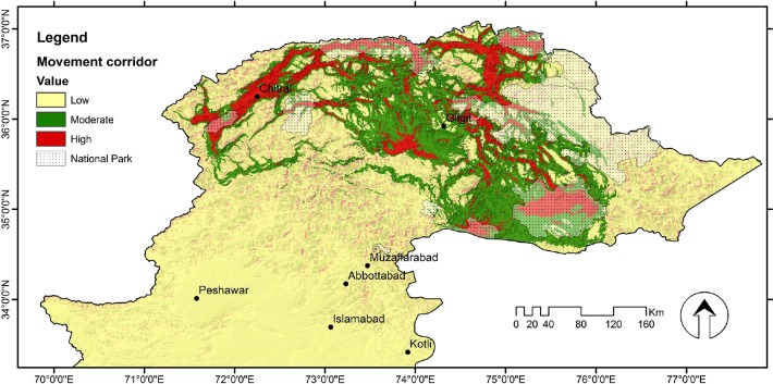
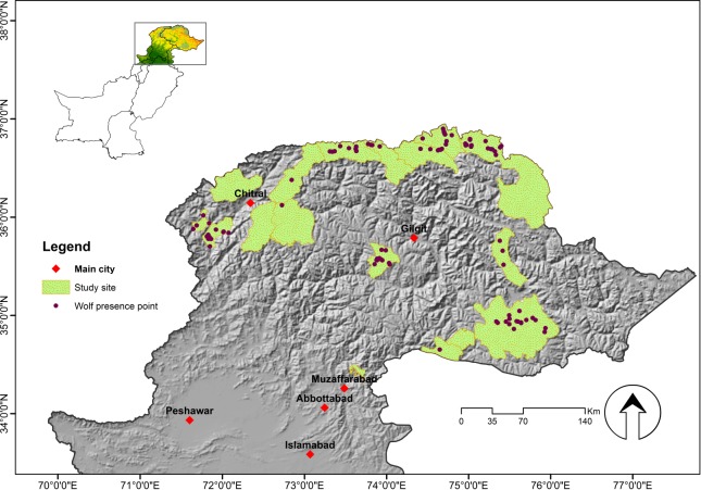
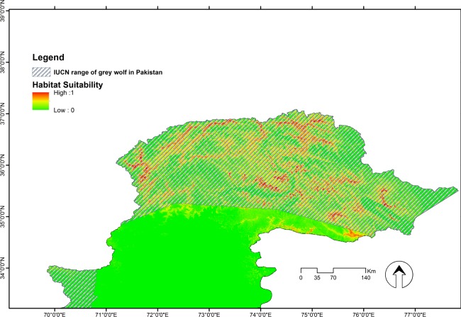
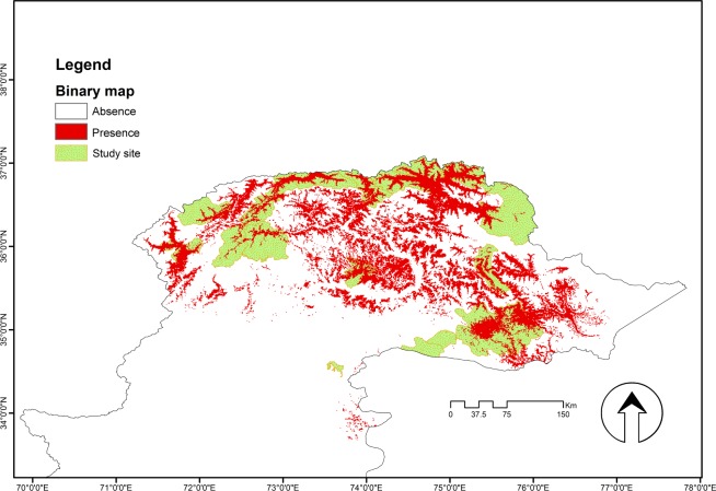
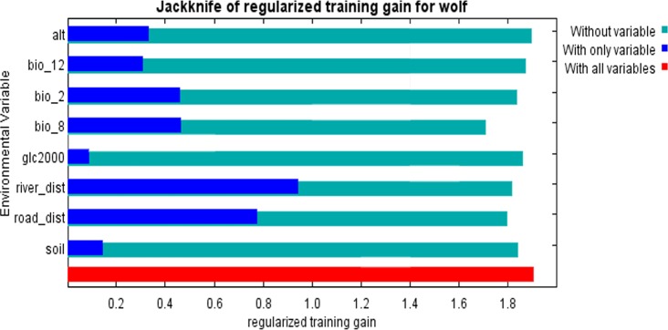
Habitat suitability models are useful to understand species distribution and to guide management and conservation strategies. The grey wolf (Canis lupus) has been extirpated from most of its historic range in Pakistan primarily due to its impact on livestock and livelihoods. We used non-invasive survey data from camera traps and genetic sampling to develop a habitat suitability model for C. lupus in northern Pakistan and to explore the extent of connectivity among populations. We detected suitable habitat of grey wolf using a maximum entropy approach (Maxent ver. 3.4.0) and identified suitable movement corridors using the Circuitscape 4.0 tool. Our model showed high levels of predictive performances, as seen from the values of area under curve (0.971±0.002) and true skill statistics (0.886±0.021). The main predictors for habitat suitability for C. lupus were distances to road, mean temperature of the wettest quarter and distance to river. The model predicted ca. 23,129 km2 of suitable areas for wolf in Pakistan, with much of suitable habitat in remote and inaccessible areas that appeared to be well connected through vulnerable movement corridors. These movement corridors suggest that potentially the wolf range can expand in Pakistan's Northern Areas. However, managing protected areas with stringent restrictions is challenging in northern Pakistan, in part due to heavy dependence of people on natural resources. The habitat suitability map provided by this study can inform future management strategies by helping authorities to identify key conservation areas.
栖息地适宜性模型有助于了解物种分布,并指导管理和保护策略。灰狼(Canis lupus)在巴基斯坦大部分历史分布范围内已被灭绝,主要原因是其对牲畜和生计造成影响。我们利用来自相机陷阱和基因采样的非侵入性调查数据,为巴基斯坦北部的灰狼建立了栖息地适宜性模型,并探讨了种群之间的连通程度。我们使用最大熵方法(Maxent ver. 3.4.0)检测了灰狼的适宜栖息地,并使用Circuitscape 4.0工具确定了适宜的移动廊道。从曲线下面积值(0.971±0.002)和真实技能统计值(0.886±0.021)可以看出,我们的模型显示出较高的预测性能。灰狼栖息地适宜性的主要预测因子是到道路的距离、最湿润季度的平均温度和到河流的距离。该模型预测巴基斯坦约有23,129平方公里的适宜狼生存的区域,其中许多适宜栖息地位于偏远且难以到达的地区,这些地区似乎通过脆弱的移动廊道连接良好。这些移动廊道表明,狼的活动范围在巴基斯坦北部地区有可能扩大。然而,在巴基斯坦北部,严格限制管理保护区具有挑战性,部分原因是人们对自然资源的严重依赖。本研究提供的栖息地适宜性地图可以帮助当局确定关键的保护区,从而为未来的管理策略提供参考。