Department of Energy Science, Sungkyunkwan University, Suwon, 16419, Korea.
Department of Physics and Astronomy, University of Rochester, Rochester, NY, 14627, USA.
Nat Commun. 2017 Dec 20;8(1):2229. doi: 10.1038/s41467-017-02374-7.
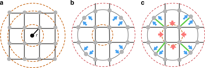
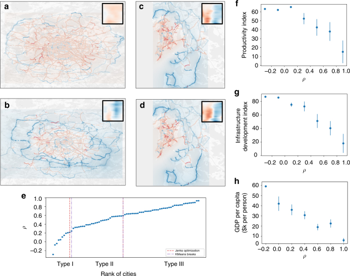
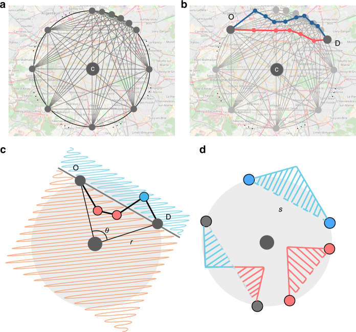
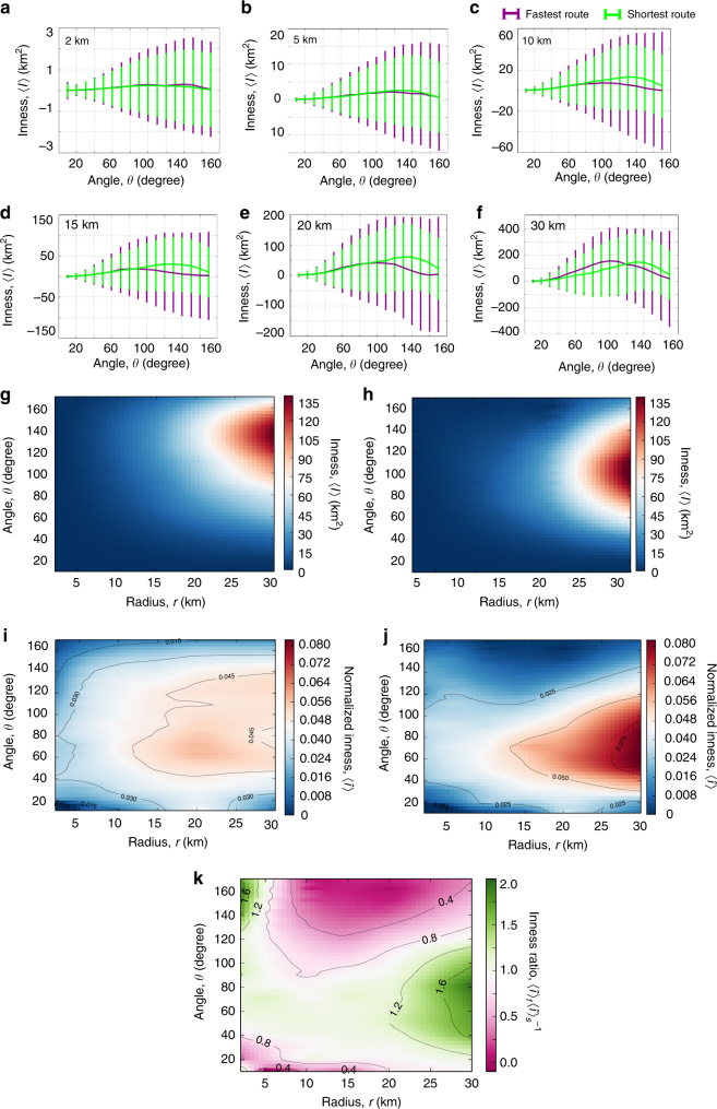
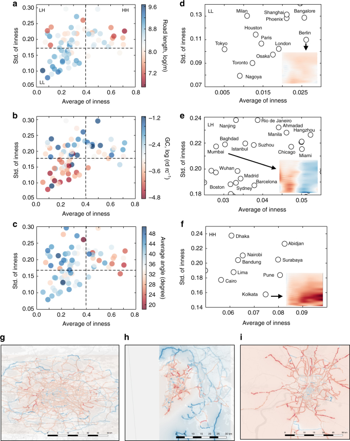
The city is a complex system that evolves through its inherent social and economic interactions. Mediating the movements of people and resources, urban street networks offer a spatial footprint of these activities. Of particular interest is the interplay between street structure and its functional usage. Here, we study the shape of 472,040 spatiotemporally optimized travel routes in the 92 most populated cities in the world, finding that their collective morphology exhibits a directional bias influenced by the attractive (or repulsive) forces resulting from congestion, accessibility, and travel demand. To capture this, we develop a simple geometric measure, inness, that maps this force field. In particular, cities with common inness patterns cluster together in groups that are correlated with their putative stage of urban development as measured by a series of socio-economic and infrastructural indicators, suggesting a strong connection between urban development, increasing physical connectivity, and diversity of road hierarchies.
城市是一个复杂的系统,通过其内在的社会和经济互动而发展。城市街道网络作为媒介,为这些活动提供了空间足迹。特别引人关注的是街道结构及其功能使用之间的相互作用。在这里,我们研究了世界上 92 个人口最多的城市中 472040 条时空优化旅行路线的形状,发现它们的集体形态表现出一种由拥堵、可达性和出行需求产生的吸引力(或排斥力)影响的方向性偏差。为了捕捉到这一点,我们开发了一种简单的几何度量——不规则度(inness),它可以映射这个力场。具体来说,具有共同不规则度模式的城市聚集在一起形成了若干组,这些组与城市发展的阶段有关,这些阶段是通过一系列社会经济和基础设施指标来衡量的,这表明城市发展、物理连通性的增加以及道路层次的多样性之间存在着紧密的联系。