School of Nursing, The University of Auckland, Auckland, New Zealand.
School of Environment and Science, Griffith University, Brisbane, Australia.
Health Place. 2021 Jan;67:102489. doi: 10.1016/j.healthplace.2020.102489. Epub 2020 Dec 7.
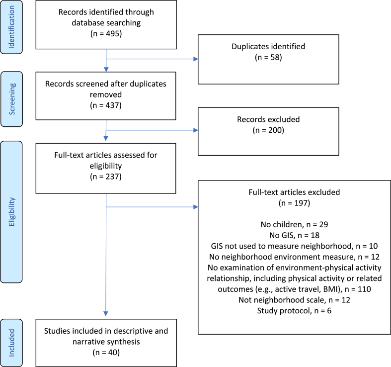
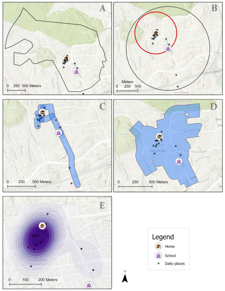
This study aimed to systematically identify, map out, and describe geographical information systems (GIS)-based approaches that have been employed to measure children's neighborhood geographies for physical activity behaviors. Forty studies were included, most were conducted in the USA. Heterogeneity in GIS methods and measures was found. The majority of studies estimated children's environments using Euclidean or network buffers ranging from 100 m to 5 km. No singular approach to measuring children's physical activity geographies was identified as optimal. Geographic diversity in studies as well as increased use of measures of actual neighborhood exposure are needed. Improved consistency and transparency in reporting research methods is urgently required.
本研究旨在系统地识别、描绘和描述基于地理信息系统 (GIS) 的方法,这些方法已被用于测量儿童的邻里环境与体力活动行为。本研究纳入了 40 项研究,其中大多数在美国进行。研究中发现 GIS 方法和指标存在异质性。大多数研究使用欧几里得或网络缓冲区来估计儿童的环境,缓冲区范围从 100 米到 5 公里不等。没有一种单一的方法被确定为测量儿童体力活动环境的最佳方法。需要在研究中增加地理多样性,并更多地使用实际邻里暴露的测量方法。迫切需要提高报告研究方法的一致性和透明度。