Department of Economics, Stanford University, Stanford, CA 94305;
National Bureau of Economic Research, Cambridge, MA 02138.
Proc Natl Acad Sci U S A. 2021 Nov 16;118(46). doi: 10.1073/pnas.2026160118.
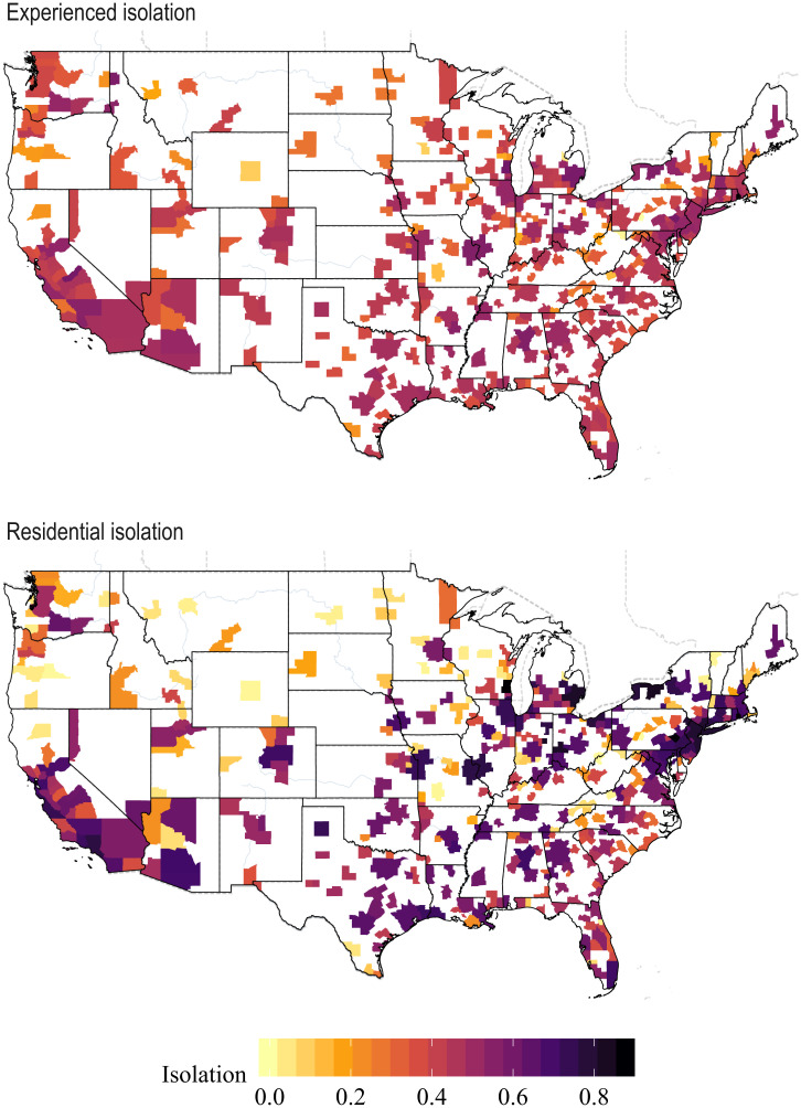
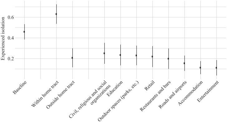
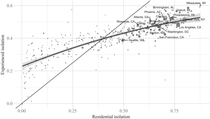
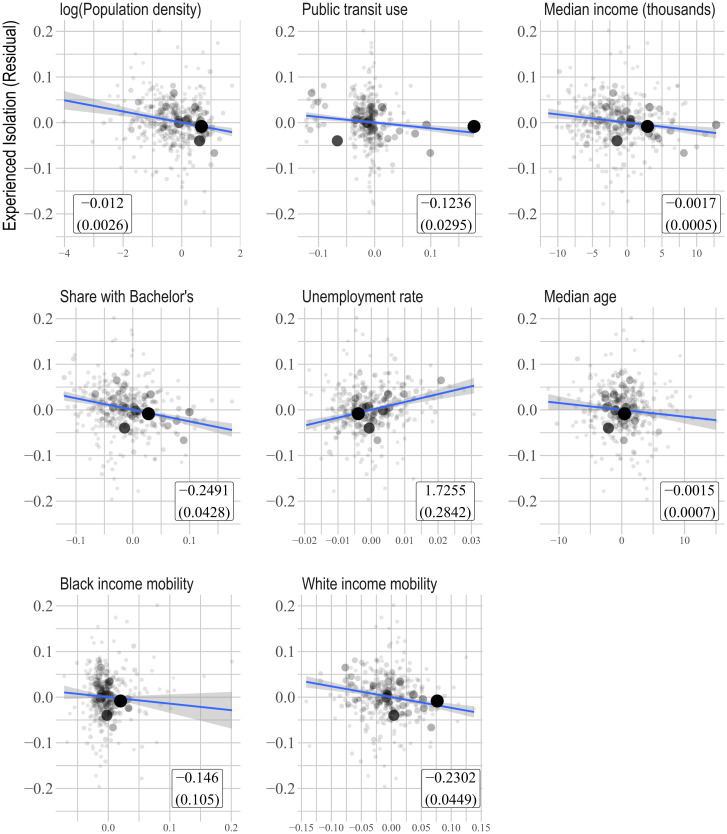
We estimate a measure of segregation, experienced isolation, that captures individuals' exposure to diverse others in the places they visit over the course of their days. Using Global Positioning System (GPS) data collected from smartphones, we measure experienced isolation by race. We find that the isolation individuals experience is substantially lower than standard residential isolation measures would suggest but that experienced isolation and residential isolation are highly correlated across cities. Experienced isolation is lower relative to residential isolation in denser, wealthier, more educated cities with high levels of public transit use and is also negatively correlated with income mobility.
我们估计了一种隔离程度的衡量标准,即个体在日常生活中接触不同人群的经历,这可以捕捉到他们在不同地点的暴露情况。我们利用智能手机采集的全球定位系统(GPS)数据,以种族为基础来衡量经历隔离的程度。我们发现,个体所经历的隔离程度要远低于标准的居住隔离措施所表明的程度,但经历隔离和居住隔离在城市之间高度相关。在人口密度较大、居民收入较高、教育程度较高、公共交通使用率较高且收入流动性较差的城市,经历隔离的程度相对于居住隔离程度较低。