College of Land Science and Technology, China Agricultural University, Beijing, 100083, China.
Key Laboratory of Remote Sensing for Agri-Hazards, Ministry of Agriculture and Rural Affairs, Beijing, 100083, China.
Sci Data. 2022 Apr 19;9(1):176. doi: 10.1038/s41597-022-01284-8.
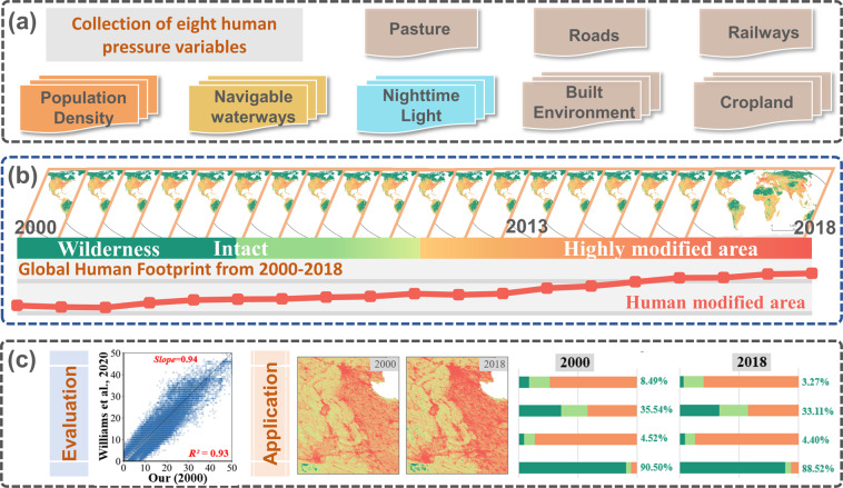
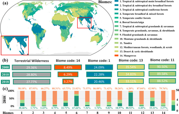
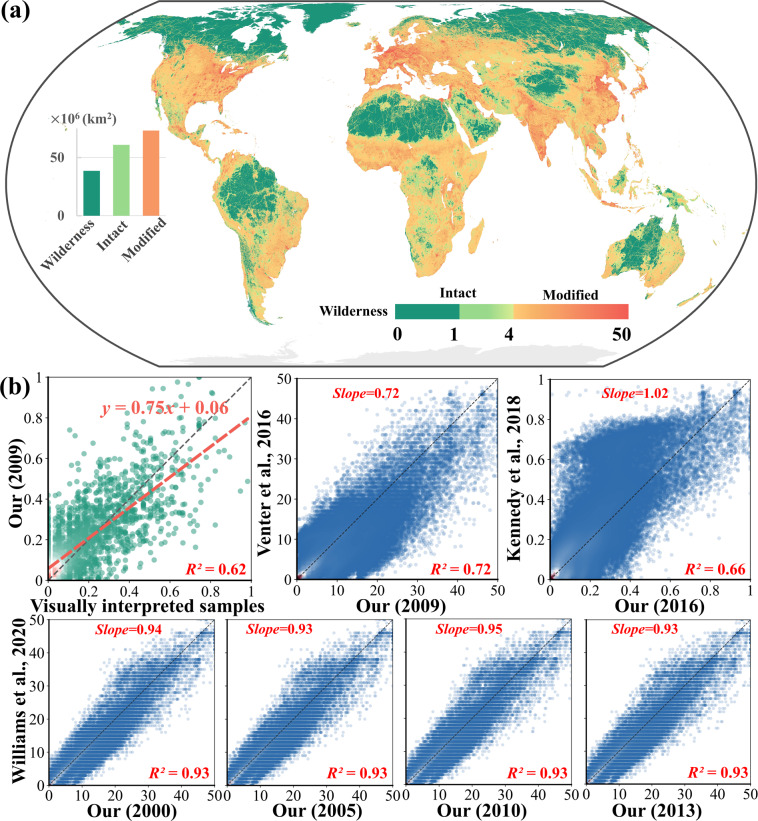
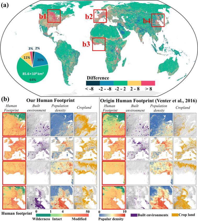
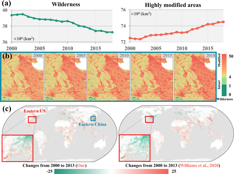
Human Footprint, the pressure imposed on the eco-environment by changing ecological processes and natural landscapes, is raising worldwide concerns on biodiversity and ecological conservation. Due to the lack of spatiotemporally consistent datasets of Human Footprint over a long temporal span, many relevant studies on this topic have been limited. Here, we mapped the annual dynamics of the global Human Footprint from 2000 to 2018 using eight variables that reflect different aspects of human pressures. The accuracy assessment revealed a good agreement between our mapped results and the previously developed datasets in different years. We found more than two million km of wilderness (i.e., regions with Human Footprint values below one) were lost over the past two decades. The biome dominated by mangroves experienced the most significant loss (i.e., above 5%) of wilderness, likely attributed to intensified human activities in coastal areas. The derived annual and spatiotemporally consistent global Human Footprint can be a fundamental dataset for many relevant studies about human activities and natural resources.
人类足迹,即人类活动改变生态过程和自然景观对生态环境造成的压力,正在引起全球对生物多样性和生态保护的关注。由于缺乏长时间跨度内时空一致的人类足迹数据集,许多相关研究受到限制。在这里,我们使用反映人类压力不同方面的八个变量,绘制了 2000 年至 2018 年全球人类足迹的年度动态。精度评估显示,我们的制图结果与不同年份开发的先前数据集之间具有良好的一致性。我们发现,在过去的二十年中,超过 200 万千米的荒野(即人类足迹值低于 1 的区域)消失了。以红树林为主的生物群系经历了最显著的荒野损失(即超过 5%),这可能归因于沿海地区人类活动的加剧。由此产生的年度和时空一致的全球人类足迹数据集可以成为许多关于人类活动和自然资源的相关研究的基础数据集。