Research Institute of the University of Bucharest, 90 Sos. Panduri, 5th Sector, 050663, Bucharest, Romania.
National Institute of Hydrology and Water Management, 97E București-Ploiești Road, 1st Sector, 013686, Bucharest, Romania.
Sci Rep. 2022 Jun 21;12(1):9393. doi: 10.1038/s41598-022-13596-1.
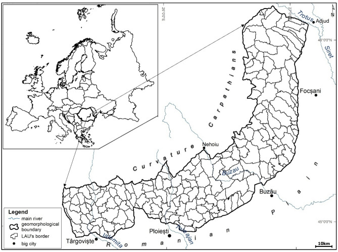
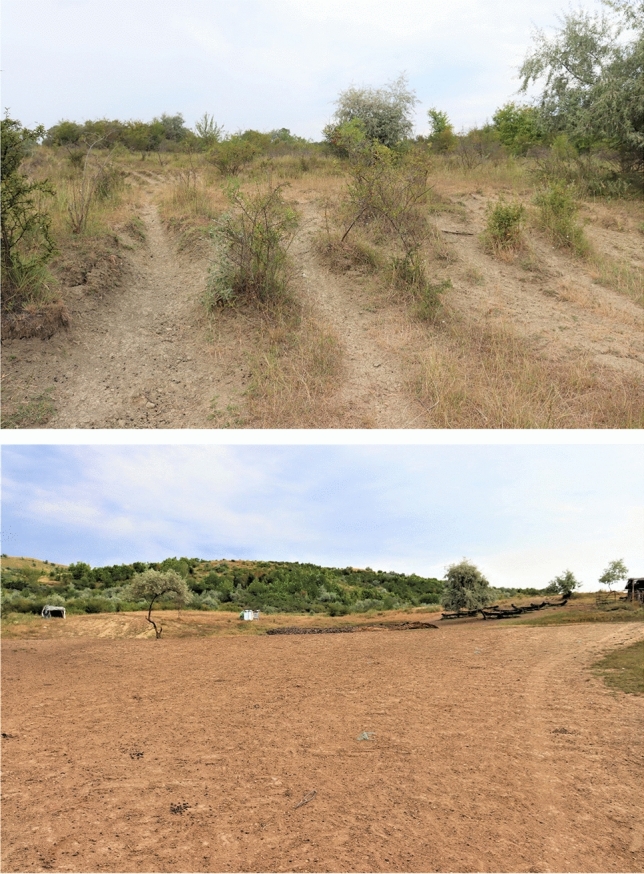
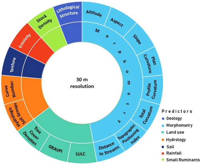
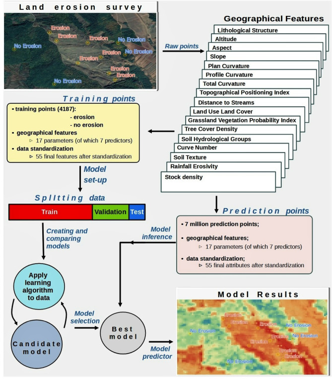
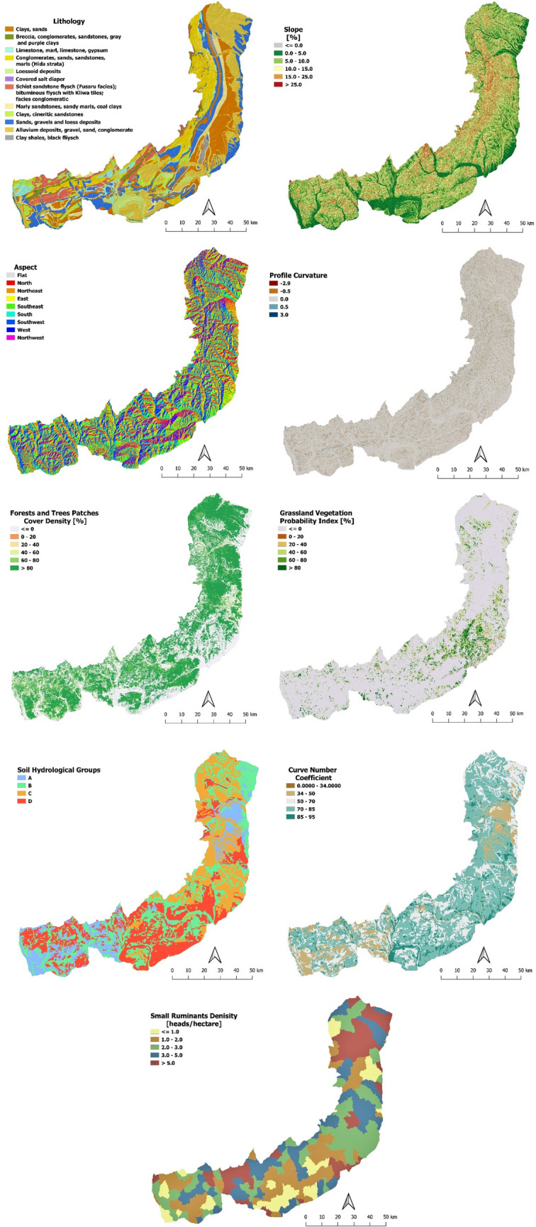
Evaluation of grazing impacts on land degradation processes is a difficult task due to the heterogeneity and complex interacting factors involved. In this paper, we designed a new methodology based on a predictive index of grazing susceptibility to land degradation index (GSLDI) built on artificial intelligence to assess land degradation susceptibility in areas affected by small ruminants (SRs) of sheep and goats grazing. The data for model training, validation, and testing consisted of sampling points (erosion and no-erosion) taken from aerial imagery. Seventeen environmental factors (e.g., derivatives of the digital elevation model, small ruminants' stock), and 55 subsequent attributes (e.g., classes/features) were assigned to each sampling point. The impact of SRs stock density on the land degradation process has been evaluated and estimated with two extreme SRs' density scenarios: absence (no stock), and double density (overstocking). We applied the GSLDI methodology to the Curvature Subcarpathians, a region that experiences the highest erosion rates in Romania, and found that SRs grazing is not the major contributor to land degradation, accounting for only 4.6%. This methodology could be replicated in other steep slope grazing areas as a tool to assess and predict susceptible to land degradation, and to establish common strategies for sustainable land-use practices.
由于涉及到异质性和复杂的相互作用因素,评估放牧对土地退化过程的影响是一项艰巨的任务。在本文中,我们设计了一种新的方法,该方法基于基于人工智能的放牧对土地退化易感性指数(GSLDI)构建了一个预测性的放牧对土地退化易感性指数(GSLDI),以评估受绵羊和山羊小反刍动物(SRs)放牧影响的地区的土地退化易感性。模型训练、验证和测试的数据由航空图像上的采样点(侵蚀和无侵蚀)组成。将 17 个环境因素(例如数字高程模型的导数、小反刍动物的存栏数)和 55 个后续属性(例如类别/特征)分配给每个采样点。通过评估和估计两种极端的 SRs 密度情景(无库存(无库存)和双倍密度(过密))来评估和估计 SRs 库存密度对土地退化过程的影响。我们将 GSLDI 方法应用于罗马尼亚侵蚀率最高的曲率次区域,发现放牧并不是土地退化的主要原因,仅占 4.6%。该方法可以在其他陡坡放牧地区复制,作为评估和预测土地退化易感性的工具,并为可持续土地利用实践建立共同的战略。