Parente Leandro, Sloat Lindsey, Mesquita Vinicius, Consoli Davide, Stanimirova Radost, Hengl Tomislav, Bonannella Carmelo, Teles Nathália, Wheeler Ichsani, Hunter Maria, Ehrmann Steffen, Ferreira Laerte, Mattos Ana Paula, Oliveira Bernard, Meyer Carsten, Şahin Murat, Witjes Martijn, Fritz Steffen, Malek Ziga, Stolle Fred
OpenGeoHub Foundation, Doorwerth, The Netherlands.
Land & Carbon Lab, World Resources Institute, Washington, DC, USA.
Sci Data. 2024 Dec 11;11(1):1303. doi: 10.1038/s41597-024-04139-6.
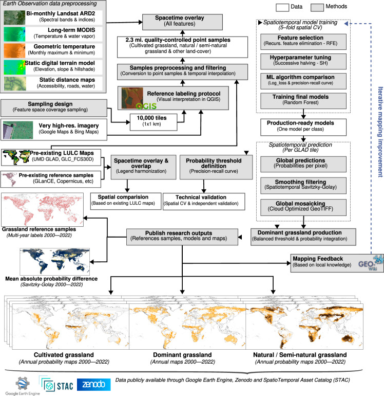
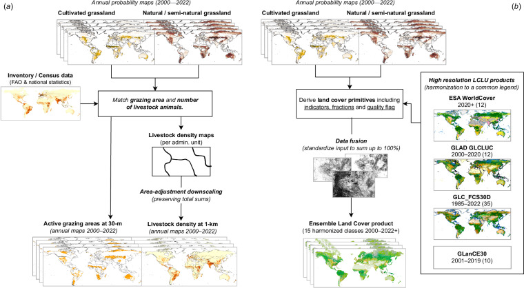
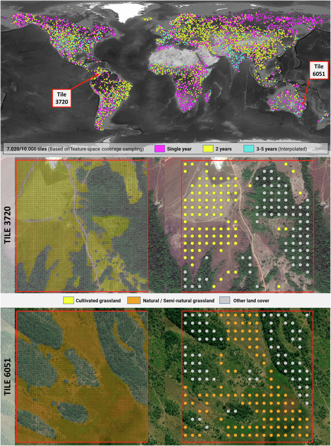
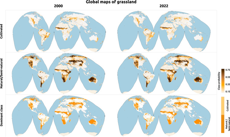
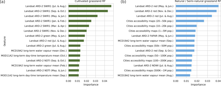
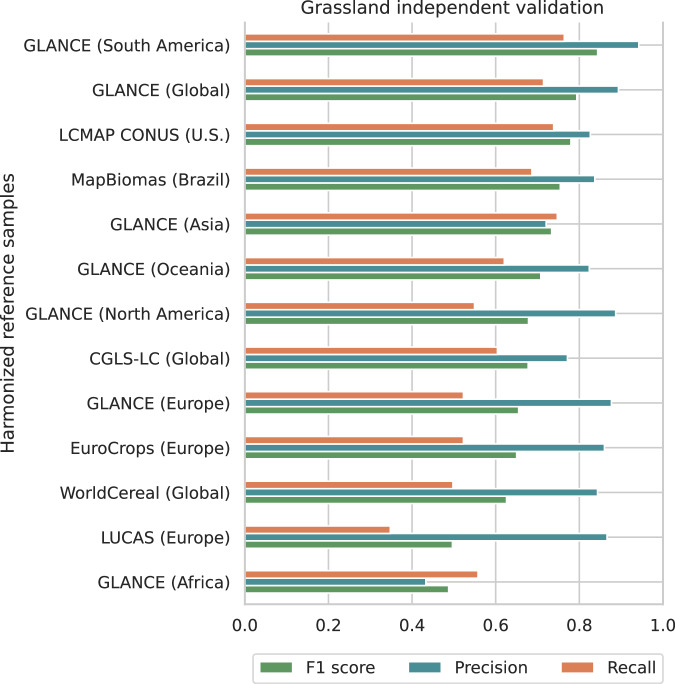
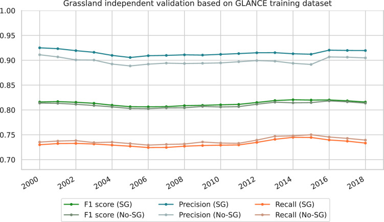
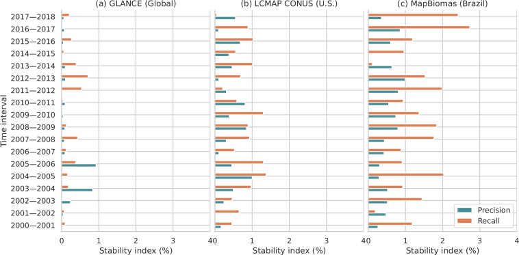
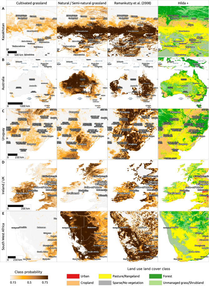
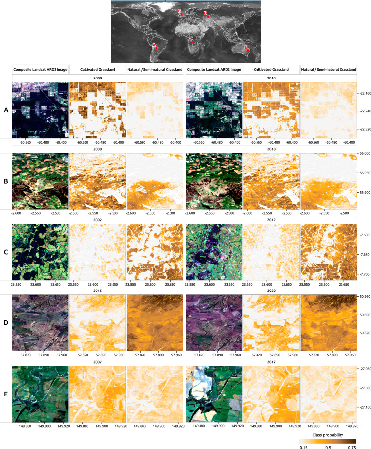
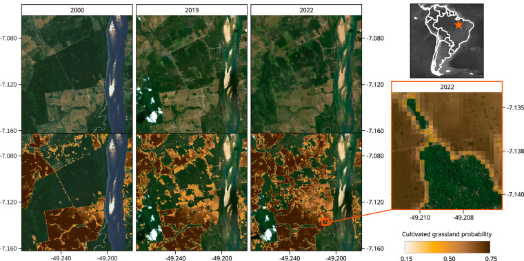
The paper describes the production and evaluation of global grassland extent mapped annually for 2000-2022 at 30 m spatial resolution. The dataset showing the spatiotemporal distribution of cultivated and natural/semi-natural grassland classes was produced by using GLAD Landsat ARD-2 image archive, accompanied by climatic, landform and proximity covariates, spatiotemporal machine learning (per-class Random Forest) and over 2.3 M reference samples (visually interpreted in Very High Resolution imagery). Custom probability thresholds (based on five-fold spatial cross-validation) were used to derive dominant class maps with balanced user's and producer's accuracy, resulting in f1 score of 0.64 and 0.75 for cultivated and natural/semi-natural grassland, respectively. The produced maps (about 4 TB in size) are available under an open data license as Cloud-Optimized GeoTIFFs and as Google Earth Engine assets. The suggested uses of data include (1) integration with other compatible land cover products and (2) tracking the intensity and drivers of conversion of land to cultivated grasslands and from natural / semi-natural grasslands into other land use systems.
本文描述了2000 - 2022年每年以30米空间分辨率绘制的全球草地范围的制作与评估。利用GLAD Landsat ARD - 2图像存档,结合气候、地形和邻近协变量、时空机器学习(逐类随机森林)以及超过230万个参考样本(在超高分辨率图像中进行目视解译),生成了显示耕地和天然/半天然草地类别的时空分布的数据集。使用自定义概率阈值(基于五折空间交叉验证)来推导具有平衡用户精度和生产者精度的优势类别地图,耕地和天然/半天然草地的F1分数分别为0.64和0.75。生成的地图(大小约4TB)可根据开放数据许可作为云优化地理TIFF文件和谷歌地球引擎资产获取。数据的建议用途包括:(1)与其他兼容的土地覆盖产品集成;(2)跟踪土地转变为人工草地以及从天然/半天然草地转变为其他土地利用系统的强度和驱动因素。