Jiang Hongtao, Gao Wenbang, Liu Baoyuan, Chang An, Guo Qiankun
College of Geographical Science, Inner Mongolia Normal University, Hohhot, 010022, China.
Inner Mongolia Autonomous Region Land Use and Renovation Engineering Technology Research Center, Hohhot, 010022, Inner Mongolia, China.
Sci Rep. 2025 Apr 24;15(1):14319. doi: 10.1038/s41598-025-98339-8.
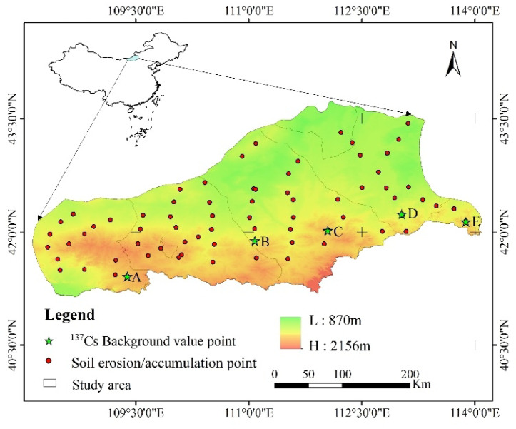
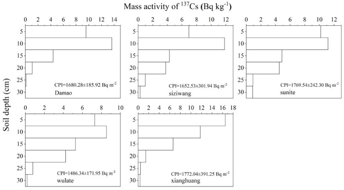
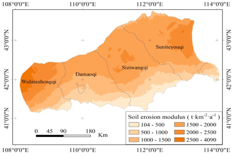
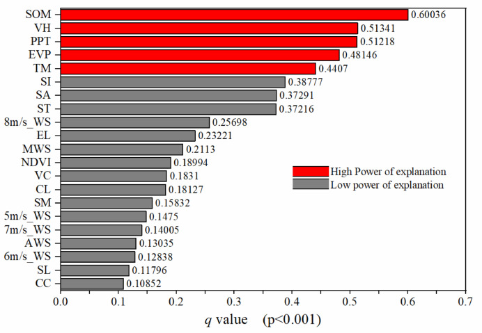
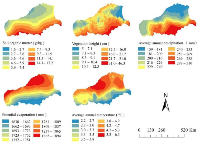
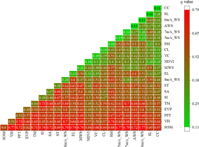
Wind erosion is a major ecological challenge in the Inner Mongolia desert grassland, directly impacting regional ecological stability and sustainable development. To gain a deeper understanding of the wind erosion process and its key driving factors, this study carefully assembled 21 indicators and quantified each factor's relative contribution to wind erosion using Cs tracing technology and geographic detectors. Data collection methods included the acquisition of soil samples, meteorological data, and vegetation cover information through remote sensing technology, along with field measurements taken at several sampling points within the study area. Data analysis was conducted using geographic detectors, which spatially identified the key factors influencing wind erosion and quantitatively assessed their contributions. Additionally, the spatial distribution of risk zones was accurately identified, analyzing wind erosion intensity and distribution patterns across different regions. The results showed that soil organic matter (SOM), vegetation height (VH), average annual precipitation (PPT), average annual temperature (AAT), and potential evaporation (PE) were the primary contributors to wind erosion, with their explanatory powers for the wind erosion modulus being 0.60, 0.51, 0.51, 0.48, and 0.44, respectively. This study provides important theoretical support for regional wind erosion control and proposes targeted management strategies to improve management efficiency and promote ecological protection and sustainable development.
风蚀是内蒙古荒漠草原面临的一项重大生态挑战,直接影响区域生态稳定和可持续发展。为了更深入地了解风蚀过程及其关键驱动因素,本研究精心选取了21个指标,并利用铯示踪技术和地理探测器量化了各因素对风蚀的相对贡献。数据收集方法包括通过遥感技术获取土壤样本、气象数据和植被覆盖信息,以及在研究区域内多个采样点进行实地测量。使用地理探测器进行数据分析,在空间上识别影响风蚀的关键因素并定量评估其贡献。此外,准确识别了风险区的空间分布,分析了不同区域的风蚀强度和分布模式。结果表明,土壤有机质(SOM)、植被高度(VH)、年均降水量(PPT)、年均温度(AAT)和潜在蒸发量(PE)是风蚀的主要贡献因素,它们对风蚀模数的解释力分别为0.60、0.51、0.51、0.48和0.44。本研究为区域风蚀控制提供了重要的理论支持,并提出了针对性的管理策略,以提高管理效率,促进生态保护和可持续发展。