Department of Geography and Environment, University of Southampton, Highfield, Southampton, UK.
Int J Health Geogr. 2014 Jan 4;13:2. doi: 10.1186/1476-072X-13-2.
The health and survival of women and their new-born babies in low income countries has been a key priority in public health since the 1990s. However, basic planning data, such as numbers of pregnancies and births, remain difficult to obtain and information is also lacking on geographic access to key services, such as facilities with skilled health workers. For maternal and newborn health and survival, planning for safer births and healthier newborns could be improved by more accurate estimations of the distributions of women of childbearing age. Moreover, subnational estimates of projected future numbers of pregnancies are needed for more effective strategies on human resources and infrastructure, while there is a need to link information on pregnancies to better information on health facilities in districts and regions so that coverage of services can be assessed.
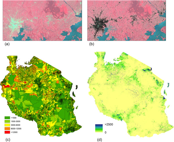
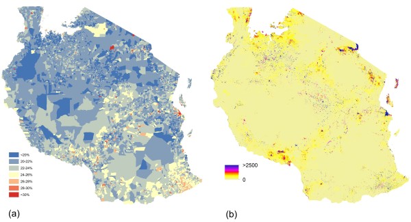
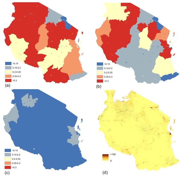
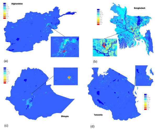
This paper outlines demographic mapping methods based on freely available data for the production of high resolution datasets depicting estimates of numbers of people, women of childbearing age, live births and pregnancies, and distribution of comprehensive EmONC facilities in four large high burden countries: Afghanistan, Bangladesh, Ethiopia and Tanzania. Satellite derived maps of settlements and land cover were constructed and used to redistribute areal census counts to produce detailed maps of the distributions of women of childbearing age. Household survey data, UN statistics and other sources on growth rates, age specific fertility rates, live births, stillbirths and abortions were then integrated to convert the population distribution datasets to gridded estimates of births and pregnancies.
These estimates, which can be produced for current, past or future years based on standard demographic projections, can provide the basis for strategic intelligence, planning services, and provide denominators for subnational indicators to track progress. The datasets produced are part of national midwifery workforce assessments conducted in collaboration with the respective Ministries of Health and the United Nations Population Fund (UNFPA) to identify disparities between population needs, health infrastructure and workforce supply. The datasets are available to the respective Ministries as part of the UNFPA programme to inform midwifery workforce planning and also publicly available through the WorldPop population mapping project.
自 20 世纪 90 年代以来,低收入国家的妇女及其新生儿的健康和生存一直是公共卫生的重点。然而,基本的规划数据,如妊娠和分娩数量,仍然难以获得,有关关键服务(如具有熟练卫生工作者的设施)的地理获取途径的信息也缺乏。为了促进母婴健康和生存,通过更准确地估计育龄妇女的分布情况,可以更好地规划更安全的分娩和更健康的新生儿。此外,需要对未来预期妊娠人数进行次国家级估计,以制定更有效的人力资源和基础设施战略,同时需要将妊娠信息与有关地区卫生设施的更好信息联系起来,以便评估服务覆盖情况。
本文概述了基于免费提供的数据制作高分辨率数据集的人口统计绘图方法,这些数据集描绘了四个高负担国家(阿富汗、孟加拉国、埃塞俄比亚和坦桑尼亚)的人口、育龄妇女、活产和妊娠人数以及全面急诊产科护理设施分布的估计数。构建了基于卫星的定居点和土地覆盖地图,并将其用于重新分配区域人口普查计数,以制作育龄妇女分布的详细地图。然后,将来自家庭调查数据、联合国统计数据和其他来源的增长率、特定年龄生育率、活产、死产和流产数据整合起来,将人口分布数据集转换为妊娠和分娩的网格化估计数。
这些估计数可根据标准人口预测,为当前、过去或未来年份制作,可作为战略情报、规划服务的基础,并为跟踪进展情况提供省级指标的分母。所制作的数据集是与各国卫生部以及联合国人口基金(人口基金)合作进行的国家助产士劳动力评估的一部分,以查明人口需求、卫生基础设施和劳动力供应之间的差距。数据集作为人口基金方案的一部分提供给各国卫生部,以告知助产士劳动力规划,并通过世界人口映射项目公开提供。