Chen Kai, Huang Lei, Zhou Lian, Ma Zongwei, Bi Jun, Li Tiantian
State Key Laboratory of Pollution Control and Resource Reuse, School of the Environment, Nanjing University, Nanjing, China.
Jiangsu Provincial Centre for Disease Prevention and Control, Nanjing, China.
Sci Rep. 2015 Jun 2;5:10816. doi: 10.1038/srep10816.
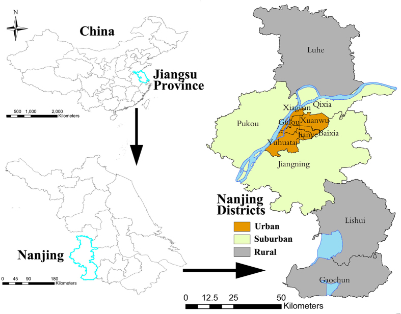
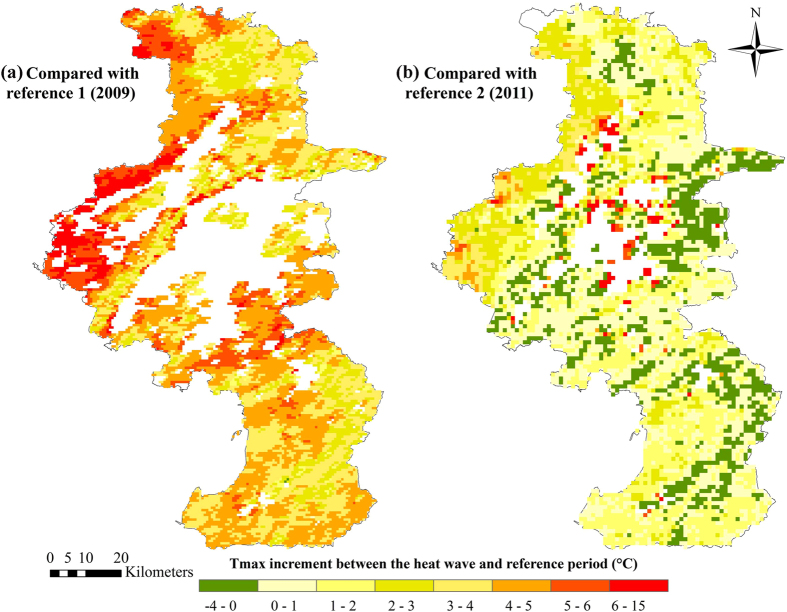
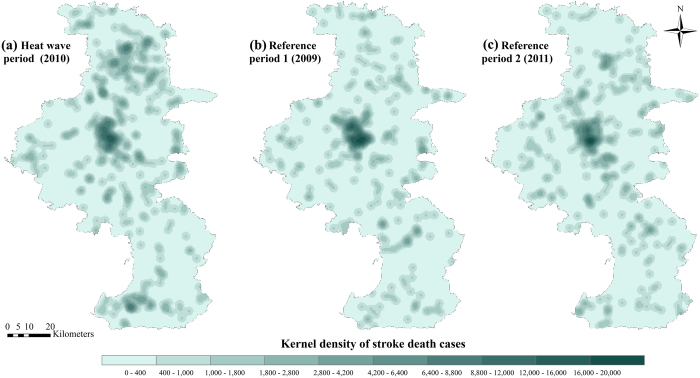
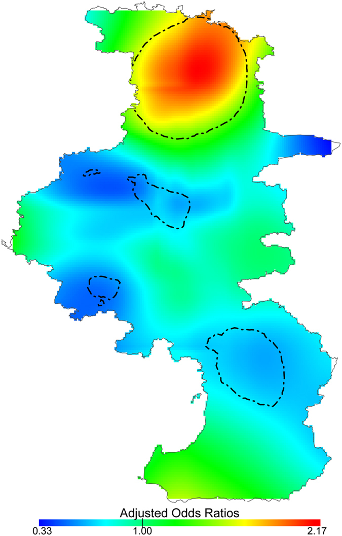
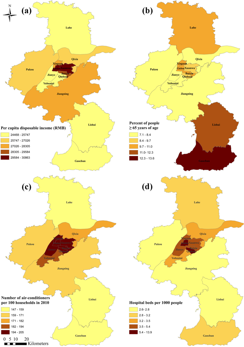
To examine the spatial variation of stroke mortality risk during heat wave, we collected 418 stroke mortality cases with permanent addresses for a severe heat wave (July 28-August 15, 2010) and 624 cases for the reference period (July 29-August 16, 2009 and July 27-August 14, 2011) in Nanjing, China. Generalized additive models were used to explore the association between location and stroke mortality risk during the heat wave while controlling individual-level risk factors. Heat wave vulnerability was then applied to explain the possible spatial variations of heat-wave-related mortality risk. The overall risk ratio (95% confidence intervals) of stroke mortality due to the heat wave in Nanjing was 1.34 (1.21 to 1.47). Geolocation was found to be significantly associated with the heat-wave-related stroke mortality risk. Using alternative reference periods generated similar results. A district-level risk assessment revealed similar spatial patterns. The highest stroke mortality risk observed in Luhe district was due to the combination of high heat exposure and high vulnerability. Our findings provide evidence that stroke mortality risk is higher in rural areas during heat waves and that these areas require future interventions to reduce vulnerability.
为研究热浪期间中风死亡风险的空间变化,我们收集了中国南京418例在严重热浪期间(2010年7月28日至8月15日)有常住地址的中风死亡病例,以及624例参考期间(2009年7月29日至8月16日和2011年7月27日至8月14日)的病例。在控制个体层面风险因素的同时,使用广义相加模型来探究热浪期间地点与中风死亡风险之间的关联。然后应用热浪脆弱性来解释与热浪相关的死亡风险可能存在的空间变化。南京因热浪导致的中风死亡总体风险比(95%置信区间)为1.34(1.21至1.47)。发现地理位置与热浪相关的中风死亡风险显著相关。使用替代参考期产生了类似的结果。区级风险评估显示了类似的空间模式。在六合区观察到的最高中风死亡风险是由于高热浪暴露和高脆弱性共同作用所致。我们的研究结果提供了证据,表明热浪期间农村地区的中风死亡风险更高,这些地区未来需要采取干预措施以降低脆弱性。