Biljecki Filip, Arroyo Ohori Ken, Ledoux Hugo, Peters Ravi, Stoter Jantien
3D Geoinformation, Delft University of Technology, Delft, The Netherlands.
PLoS One. 2016 Jun 2;11(6):e0156808. doi: 10.1371/journal.pone.0156808. eCollection 2016.
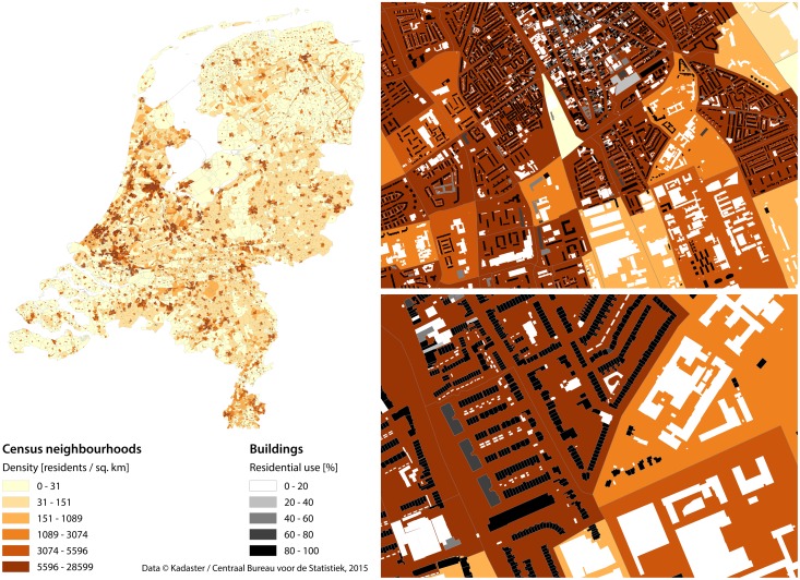
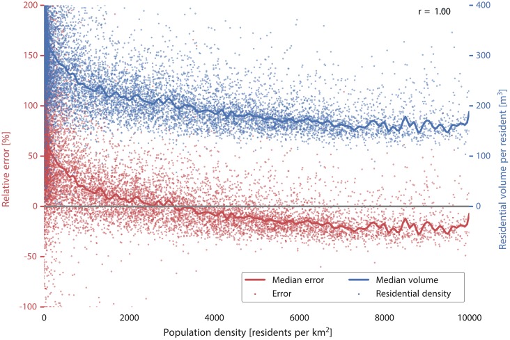
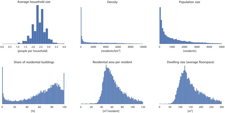
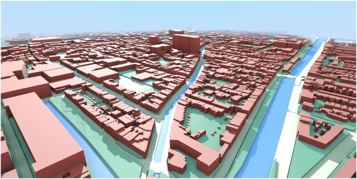
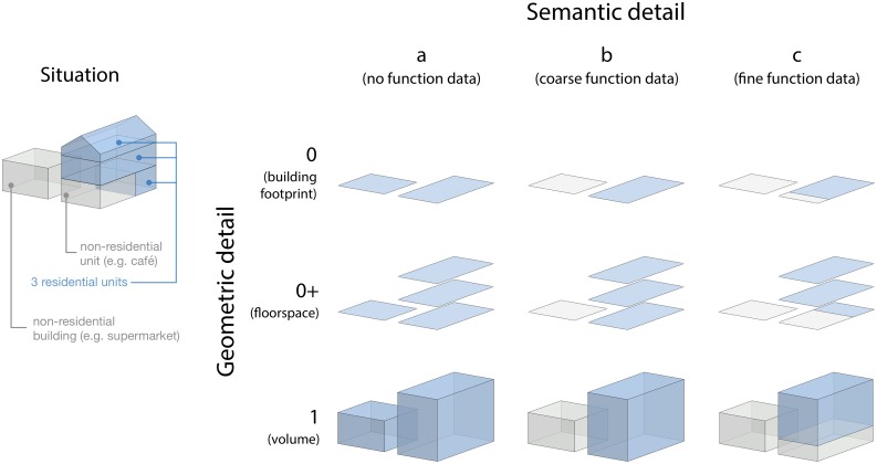
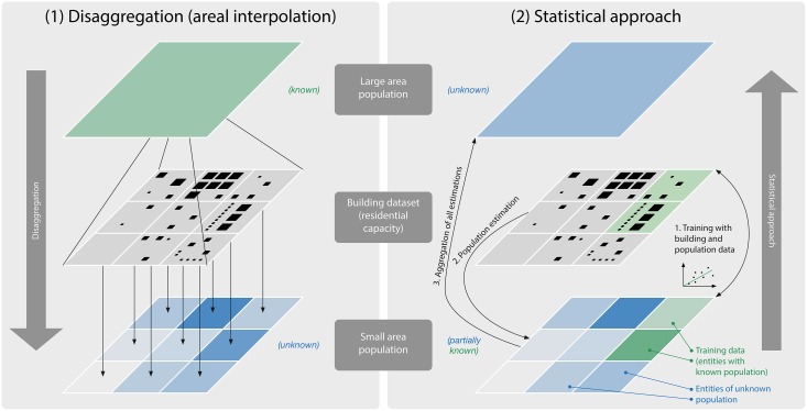
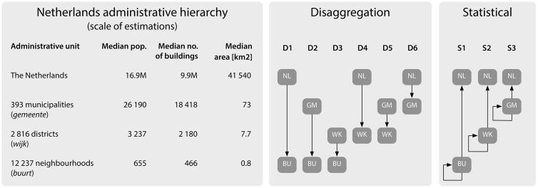
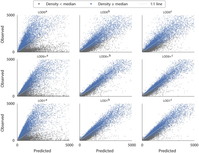
The remote estimation of a region's population has for decades been a key application of geographic information science in demography. Most studies have used 2D data (maps, satellite imagery) to estimate population avoiding field surveys and questionnaires. As the availability of semantic 3D city models is constantly increasing, we investigate to what extent they can be used for the same purpose. Based on the assumption that housing space is a proxy for the number of its residents, we use two methods to estimate the population with 3D city models in two directions: (1) disaggregation (areal interpolation) to estimate the population of small administrative entities (e.g. neighbourhoods) from that of larger ones (e.g. municipalities); and (2) a statistical modelling approach to estimate the population of large entities from a sample composed of their smaller ones (e.g. one acquired by a government register). Starting from a complete Dutch census dataset at the neighbourhood level and a 3D model of all 9.9 million buildings in the Netherlands, we compare the population estimates obtained by both methods with the actual population as reported in the census, and use it to evaluate the quality that can be achieved by estimations at different administrative levels. We also analyse how the volume-based estimation enabled by 3D city models fares in comparison to 2D methods using building footprints and floor areas, as well as how it is affected by different levels of semantic detail in a 3D city model. We conclude that 3D city models are useful for estimations of large areas (e.g. for a country), and that the 3D approach has clear advantages over the 2D approach.
几十年来,对一个地区人口的远程估计一直是地理信息科学在人口统计学中的一项关键应用。大多数研究使用二维数据(地图、卫星图像)来估计人口,避免进行实地调查和问卷调查。随着语义三维城市模型的可用性不断提高,我们研究它们在多大程度上可用于相同目的。基于住房空间是其居民数量的代理这一假设,我们使用两种方法从两个方向用三维城市模型估计人口:(1)分解(面积插值),从较大行政实体(如直辖市)的人口估计较小行政实体(如社区)的人口;(2)一种统计建模方法,从由较小实体组成的样本(如通过政府登记获得的样本)估计大型实体的人口。从荷兰社区层面的完整人口普查数据集和荷兰所有990万栋建筑的三维模型出发,我们将这两种方法获得的人口估计值与人口普查报告的实际人口进行比较,并用于评估不同行政层面估计所能达到的质量。我们还分析了与使用建筑物占地面积和建筑面积的二维方法相比,三维城市模型实现的基于体积的估计情况如何,以及它如何受到三维城市模型中不同语义细节水平的影响。我们得出结论,三维城市模型对大面积(如一个国家)的估计很有用,并且三维方法比二维方法具有明显优势。