Xu Min, Cao Chunxiang, Li Qun, Jia Peng, Zhao Jian
State Key Laboratory of Remote Sensing Science, Institute of Remote Sensing and Digital Earth, Chinese Academy of Sciences, Beijing 100101, China.
Public Health Emergency Center, Chinese Center for Disease Control and Prevention, Beijing 102206, China.
Int J Environ Res Public Health. 2016 Jun 16;13(6):600. doi: 10.3390/ijerph13060600.
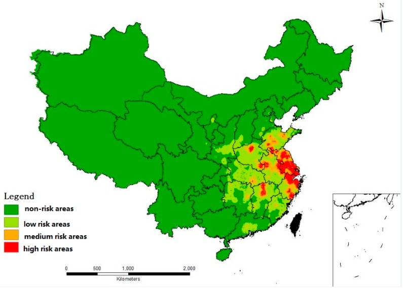
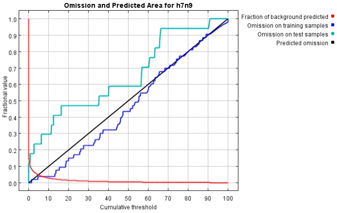
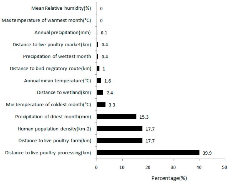
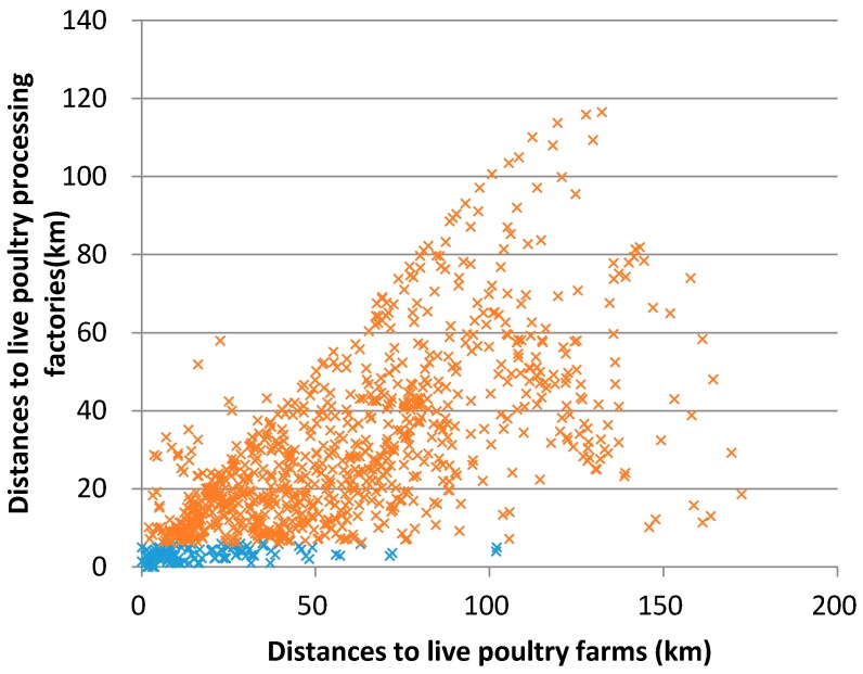
China was attacked by a serious influenza A (H7N9) virus in 2013. The first human infection case was confirmed in Shanghai City and soon spread across most of eastern China. Using the methods of Geographic Information Systems (GIS) and ecological niche modeling (ENM), this research quantitatively analyzed the relationships between the H7N9 occurrence and the main environmental factors, including meteorological variables, human population density, bird migratory routes, wetland distribution, and live poultry farms, markets, and processing factories. Based on these relationships the probability of the presence of H7N9 was predicted. Results indicated that the distribution of live poultry processing factories, farms, and human population density were the top three most important determinants of the H7N9 human infection. The relative contributions to the model of live poultry processing factories, farms and human population density were 39.9%, 17.7% and 17.7%, respectively, while the maximum temperature of the warmest month and mean relative humidity had nearly no contribution to the model. The paper has developed an ecological niche model (ENM) that predicts the spatial distribution of H7N9 cases in China using environmental variables. The area under the curve (AUC) values of the model were greater than 0.9 (0.992 for the training samples and 0.961 for the test data). The findings indicated that most of the high risk areas were distributed in the Yangtze River Delta. These findings have important significance for the Chinese government to enhance the environmental surveillance at multiple human poultry interfaces in the high risk area.
2013年中国遭受了甲型H7N9流感病毒的严重侵袭。首例人类感染病例在上海市得到确诊,随后迅速蔓延至中国东部大部分地区。本研究运用地理信息系统(GIS)和生态位建模(ENM)方法,定量分析了H7N9疫情发生与主要环境因素之间的关系,这些因素包括气象变量、人口密度、鸟类迁徙路线、湿地分布以及活禽养殖场、市场和加工厂。基于这些关系,预测了H7N9存在的可能性。结果表明,活禽加工厂、养殖场的分布以及人口密度是H7N9人类感染最重要的三大决定因素。活禽加工厂、养殖场和人口密度对模型的相对贡献分别为39.9%、17.7%和17.7%,而最暖月的最高温度和平均相对湿度对模型几乎没有贡献。本文构建了一个生态位模型(ENM),利用环境变量预测中国H7N9病例的空间分布。该模型的曲线下面积(AUC)值大于0.9(训练样本为0.992,测试数据为0.961)。研究结果表明,大多数高风险区域分布在长江三角洲地区。这些发现对于中国政府加强高风险区域多个人禽界面的环境监测具有重要意义。