Swiss Tropical and Public Health Institute, Basel, Switzerland; University of Basel, Switzerland.
Foundation for Research and Technology - Hellas, Heraklion, Greece.
Environ Int. 2018 Dec;121(Pt 1):57-70. doi: 10.1016/j.envint.2018.08.041. Epub 2018 Sep 1.
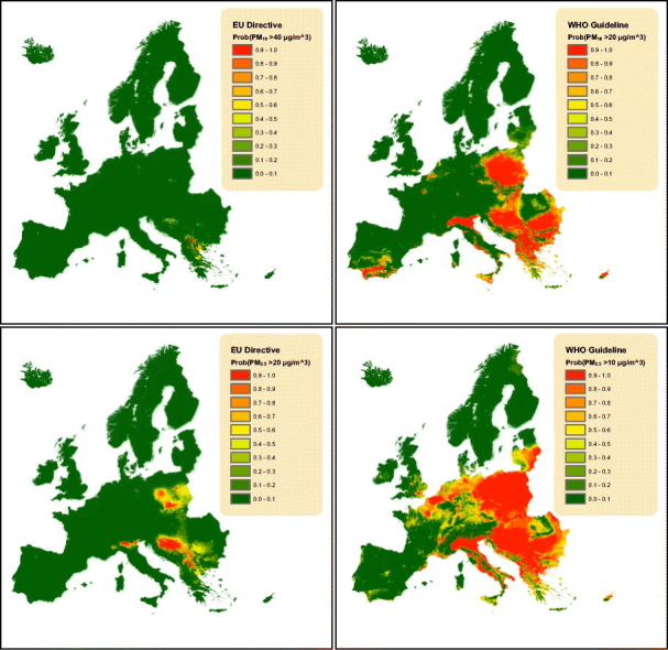
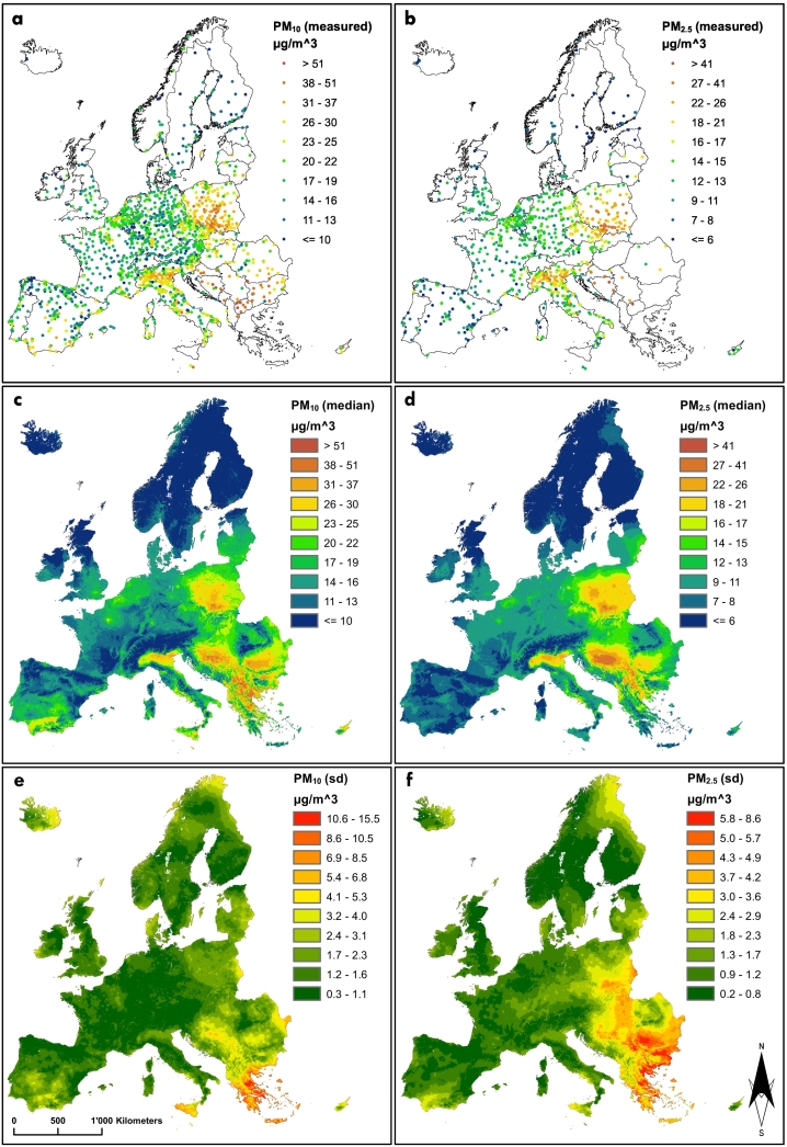
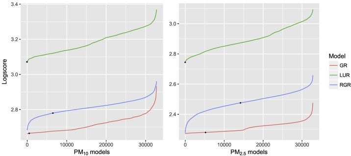
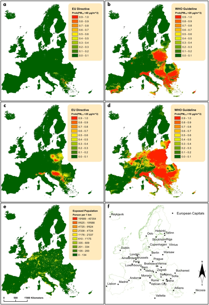
Air quality monitoring across Europe is mainly based on in situ ground stations, which are too sparse to accurately assess the exposure effects of air pollution for the entire continent. The demand for precise predictive models that estimate gridded geophysical parameters of ambient air at high spatial resolution has rapidly grown. Here, we investigate the potential of satellite-derived products to improve particulate matter (PM) estimates. Bayesian geostatistical models addressing confounding between the spatial distribution of pollutants and remotely sensed predictors were developed to estimate yearly averages of both, fine (PM) and coarse (PM) surface PM concentrations, at 1 km spatial resolution over 46 European countries. Model outcomes were compared to geostatistical, geographically weighted and land-use regression formulations. Rigorous model selection identified the Earth observation data which contribute most to pollutants' estimation. Geostatistical models outperformed the predictive ability of the frequently employed land-use regression. The resulting estimates of PM and PM, which represent the main air quality indicators for the urban Sustainable Development Goal, indicate that in 2016, 66.2% of the European population was breathing air above the WHO air quality guidelines thresholds. Our estimates are readily available to policy makers and scientists assessing the effects of long-term exposure to pollution on human and ecosystem health.
欧洲的空气质量监测主要基于现场地面站,但这些监测站过于稀疏,无法准确评估整个欧洲大陆的空气污染暴露效应。因此,人们对能够以高空间分辨率估算环境空气网格化地球物理参数的精确预测模型的需求迅速增长。在这里,我们研究了卫星衍生产品在改善颗粒物 (PM) 估算方面的潜力。开发了贝叶斯地质统计学模型,以解决污染物空间分布与遥感预测因子之间的混杂问题,从而估算 46 个欧洲国家每年每小时的细颗粒物 (PM) 和粗颗粒物 (PM) 表面 PM 浓度平均值,空间分辨率为 1 公里。将模型结果与地质统计学、地理加权和土地利用回归公式进行了比较。严格的模型选择确定了对污染物估算贡献最大的观测数据。地质统计学模型的预测能力优于常用的土地利用回归。由此得出的 PM 和 PM 估计值代表了城市可持续发展目标的主要空气质量指标,表明 2016 年,欧洲有 66.2%的人口呼吸的空气超过了世卫组织空气质量指南的阈值。我们的估计值可供政策制定者和科学家使用,用于评估长期暴露于污染对人类和生态系统健康的影响。