GIScience Research Group, Institute of Geography, Heidelberg University, 69120 Heidelberg, Germany.
Sensors (Basel). 2018 Nov 6;18(11):3794. doi: 10.3390/s18113794.
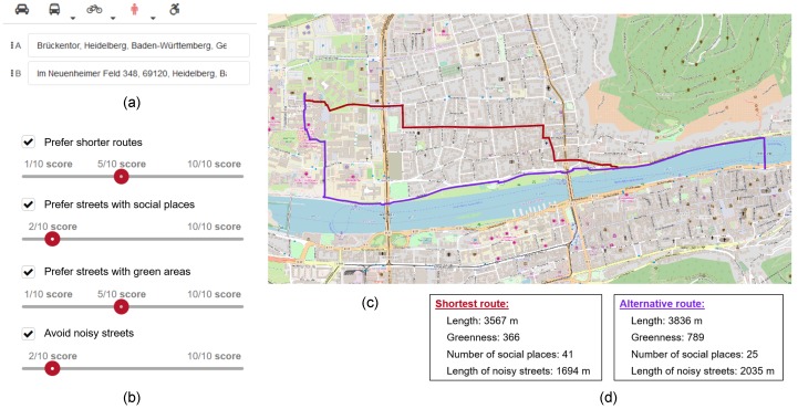
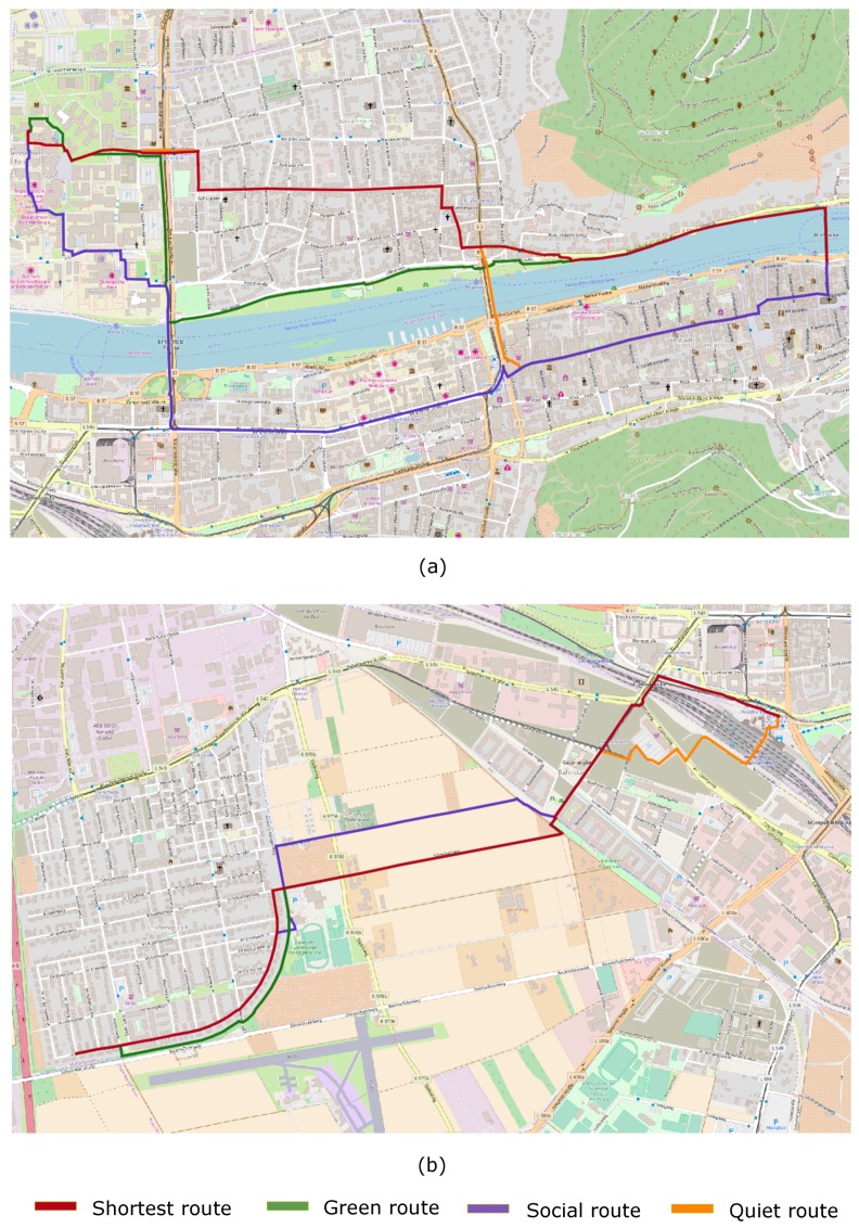
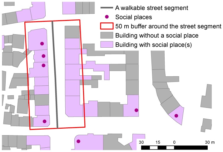
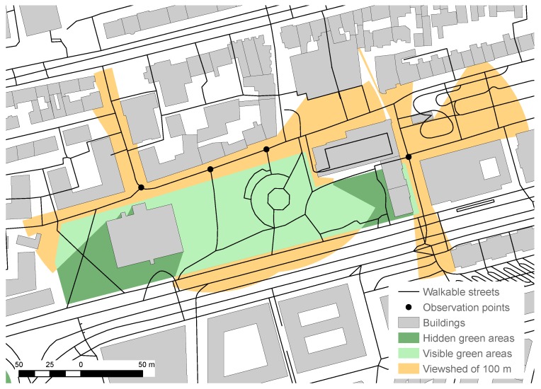
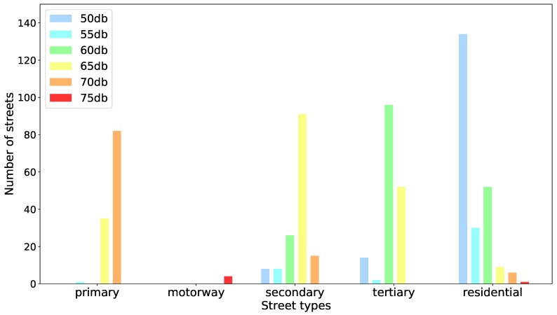
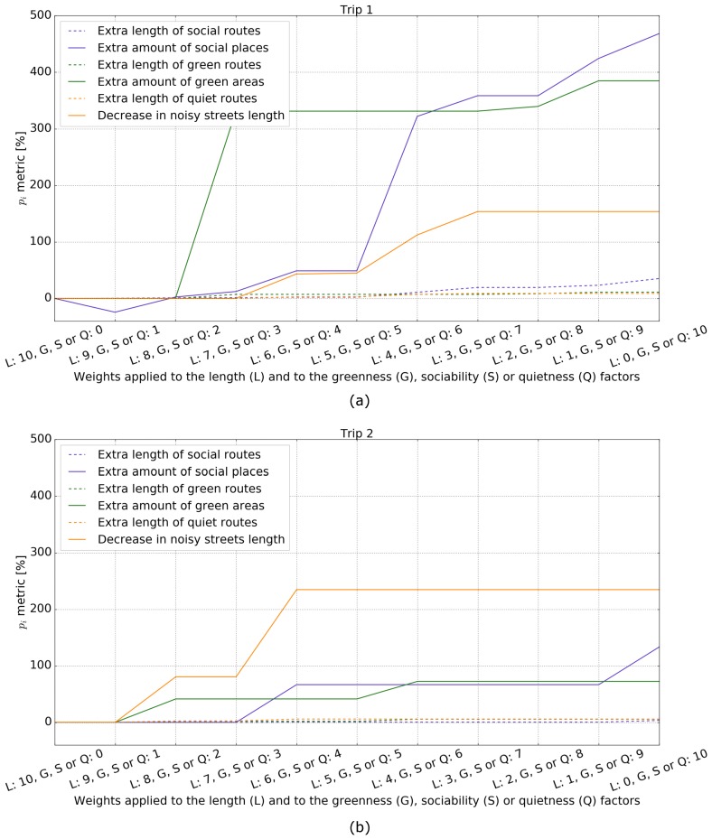
In this work, we present a system that generates customized pedestrian routes entirely based on data from OpenStreetMap (OSM). The system enables users to define to what extent they would like the route to have green areas (e.g., parks, squares, trees), social places (e.g., cafes, restaurants, shops) and quieter streets (i.e., with less road traffic). We present how the greenness, sociability, and quietness factors are defined and extracted from OSM as well as how they are integrated into a routing cost function. We intrinsically evaluate customized routes from one-thousand trips, i.e., origin⁻destination pairs, and observe that these are, in general, as we intended-slightly longer but significantly more social, greener, and quieter than the respective shortest routes. Based on a survey taken by 156 individuals, we also evaluate the system's usefulness, usability, controlability, and transparency. The majority of the survey participants agree that the system is useful and easy to use and that it gives them the feeling of being in control regarding the extraction of routes in accordance with their greenness, sociability, and quietness preferences. The survey also provides valuable insights into users requirements and wishes regarding a tool for interactively generating customized pedestrian routes.
在这项工作中,我们提出了一个完全基于 OpenStreetMap(OSM)数据生成定制行人路线的系统。该系统使用户能够定义他们希望路线具有多大程度的绿色区域(如公园、广场、树木)、社交场所(如咖啡馆、餐馆、商店)和更安静的街道(即交通流量较少的街道)。我们介绍了如何从 OSM 中定义和提取绿色性、社交性和安静性因素,以及如何将它们集成到路由成本函数中。我们从一千次旅行(即起点-目的地对)中内在评估定制路线,并观察到这些路线通常比各自的最短路线略长,但明显更具社交性、更绿色、更安静。基于 156 个人的调查,我们还评估了系统的有用性、可用性、可控性和透明度。大多数调查参与者认为该系统有用且易于使用,并且让他们感觉在按照自己的绿色性、社交性和安静性偏好提取路线方面具有掌控感。该调查还提供了有关交互式生成定制行人路线工具的用户需求和愿望的有价值的见解。