Xing Yanru, Hernandez Nopsa John F, Andersen Kelsey F, Andrade-Piedra Jorge L, Beed Fenton D, Blomme Guy, Carvajal-Yepes Mónica, Coyne Danny L, Cuellar Wilmer J, Forbes Gregory A, Kreuze Jan F, Kroschel Jürgen, Kumar P Lava, Legg James P, Parker Monica, Schulte-Geldermann Elmar, Sharma Kalpana, Garrett Karen A
Plant Pathology Department, Institute for Sustainable Food Systems, and Emerging Pathogens Institute at University of Florida, Gainesville, USA.
Corporación Colombiana de Investigación Agropecuaria, AGROSAVIA, Mosquera-Bogota, Colombia.
Bioscience. 2020 Jul 29;70(9):744-758. doi: 10.1093/biosci/biaa067. eCollection 2020 Sep.
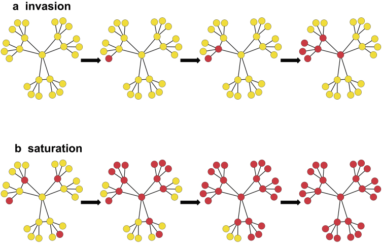
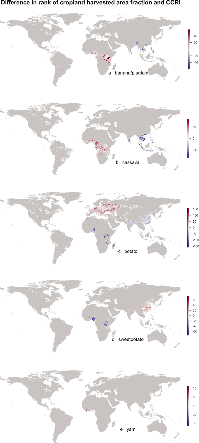
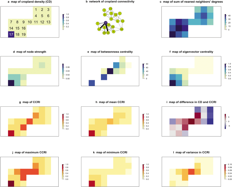
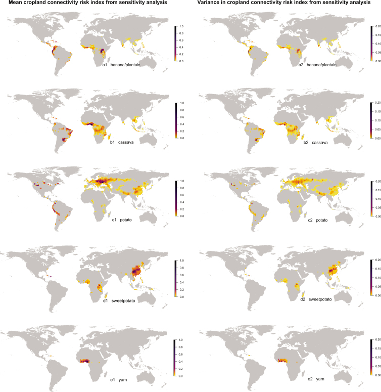
The geographic pattern of cropland is an important risk factor for invasion and saturation by crop-specific pathogens and arthropods. Understanding cropland networks supports smart pest sampling and mitigation strategies. We evaluate global networks of cropland connectivity for key vegetatively propagated crops (banana and plantain, cassava, potato, sweet potato, and yam) important for food security in the tropics. For each crop, potential movement between geographic location pairs was evaluated using a gravity model, with associated uncertainty quantification. The highly linked hub and bridge locations in cropland connectivity risk maps are likely priorities for surveillance and management, and for tracing intraregion movement of pathogens and pests. Important locations are identified beyond those locations that simply have high crop density. Cropland connectivity risk maps provide a new risk component for integration with other factors-such as climatic suitability, genetic resistance, and global trade routes-to inform pest risk assessment and mitigation.
农田的地理格局是特定作物病原体和节肢动物入侵与饱和的重要风险因素。了解农田网络有助于制定明智的害虫采样和缓解策略。我们评估了对热带地区粮食安全至关重要的主要营养繁殖作物(香蕉和大蕉、木薯、马铃薯、甘薯和山药)的全球农田连通性网络。对于每种作物,使用重力模型评估地理位置对之间的潜在移动,并进行相关的不确定性量化。农田连通性风险地图中高度相连的枢纽和桥梁位置可能是监测和管理的重点,也是追踪病原体和害虫区域内移动的重点。除了作物密度高的地点之外,还确定了重要地点。农田连通性风险地图为与其他因素(如气候适宜性、遗传抗性和全球贸易路线)整合提供了一个新的风险组成部分,以指导害虫风险评估和缓解。