College of Liberal and General Education, Aletheia University, Republic of China, Taiwan.
BMC Public Health. 2009 Dec 14;9:464. doi: 10.1186/1471-2458-9-464.
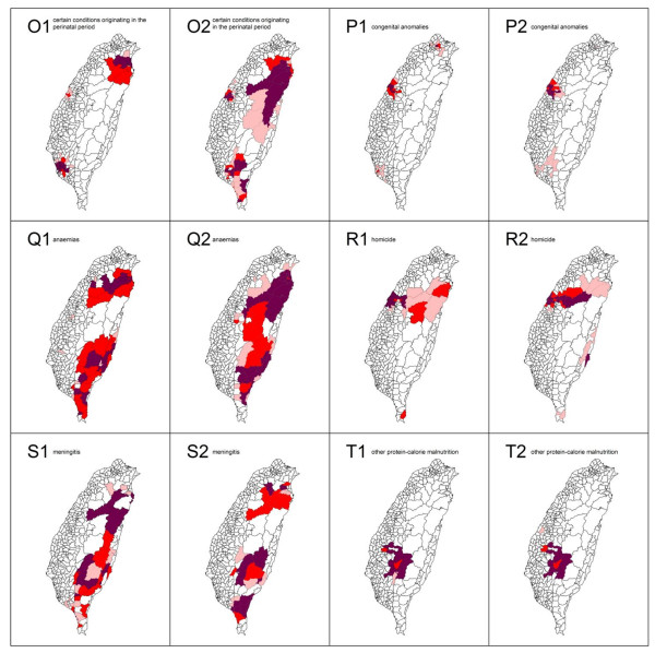
Spatial analytical techniques and models are often used in epidemiology to identify spatial anomalies (hotspots) in disease regions. These analytical approaches can be used to not only identify the location of such hotspots, but also their spatial patterns.
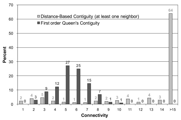
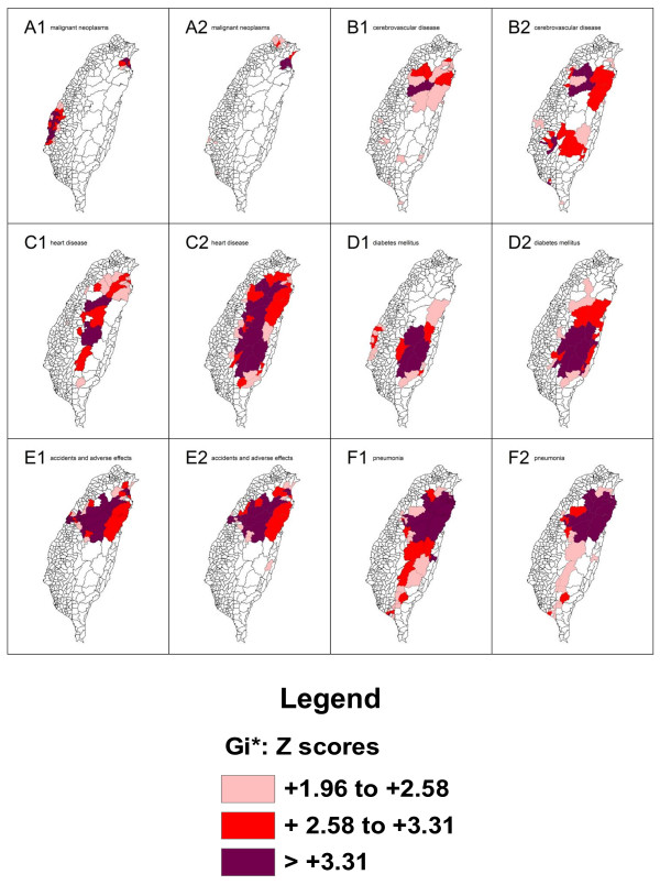
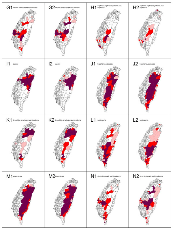
In this study, we utilize spatial autocorrelation methodologies, including Global Moran's I and Local Getis-Ord statistics, to describe and map spatial clusters, and areas in which these are situated, for the 20 leading causes of death in Taiwan. In addition, we use the fit to a logistic regression model to test the characteristics of similarity and dissimilarity by gender.
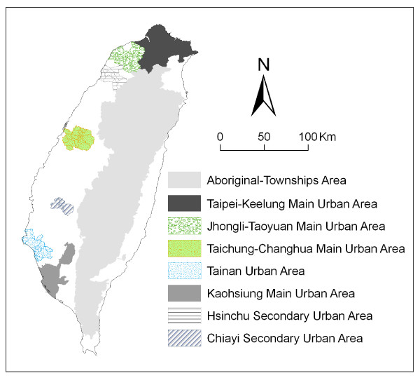
Gender is compared in efforts to formulate the common spatial risk. The mean found by local spatial autocorrelation analysis is utilized to identify spatial cluster patterns. There is naturally great interest in discovering the relationship between the leading causes of death and well-documented spatial risk factors. For example, in Taiwan, we found the geographical distribution of clusters where there is a prevalence of tuberculosis to closely correspond to the location of aboriginal townships.
Cluster mapping helps to clarify issues such as the spatial aspects of both internal and external correlations for leading health care events. This is of great aid in assessing spatial risk factors, which in turn facilitates the planning of the most advantageous types of health care policies and implementation of effective health care services.
空间分析技术和模型常用于流行病学中,以识别疾病区域的空间异常(热点)。这些分析方法不仅可以识别热点的位置,还可以描述其空间模式。
本研究利用空间自相关方法,包括全局 Moran's I 和局部 Getis-Ord 统计,描述和绘制台湾 20 大死因的空间聚类及其所在区域,并通过逻辑回归模型拟合来检验性别相似性和相异性的特征。
通过比较性别来制定共同的空间风险。利用局部空间自相关分析的均值来识别空间聚类模式。人们自然对发现主要死因与记录良好的空间风险因素之间的关系很感兴趣。例如,在台湾,我们发现结核病流行地区的集群分布与原住民乡镇的位置非常吻合。
聚类映射有助于阐明主要医疗保健事件的内部和外部相关性的空间方面等问题。这对于评估空间风险因素非常有帮助,进而有助于规划最有利的医疗保健政策类型并实施有效的医疗保健服务。