School of Geography, Beijing Normal University, 19 Xinjiekouwai Avenue, Beijing, 100875, China.
Int J Health Geogr. 2012 Aug 9;11:32. doi: 10.1186/1476-072X-11-32.
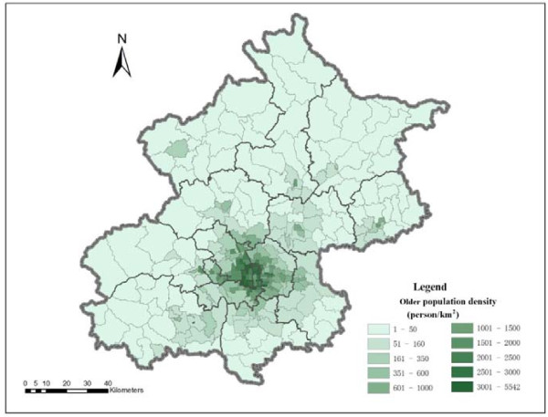
As the population is ageing rapidly in Beijing, the residential care sector is in a fast expansion process with the support of the municipal government. Understanding spatial accessibility to residential care resources by older people supports the need for rational allocation of care resources in future planning.
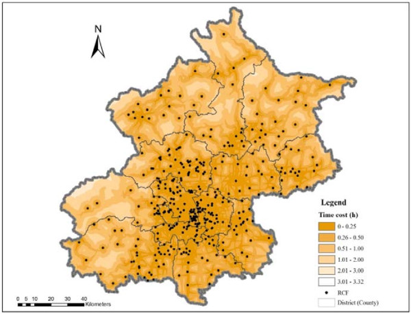
Based on population data and data on residential care resources, this study uses two Geographic Information System (GIS) based methods--shortest path analysis and a two-step floating catchment area (2SFCA) method to analyse spatial accessibility to residential care resources.
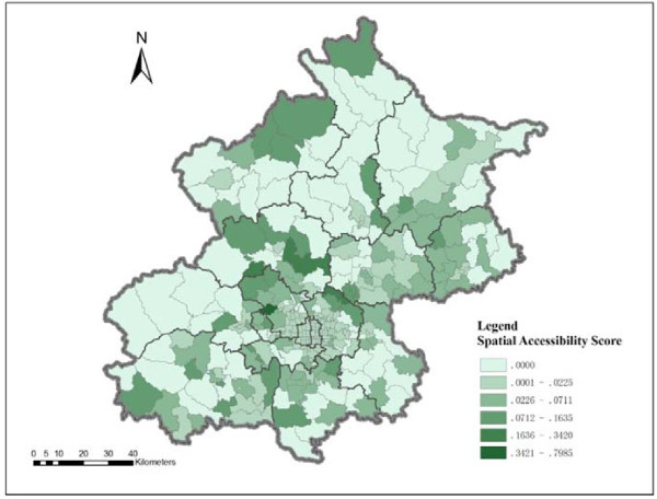
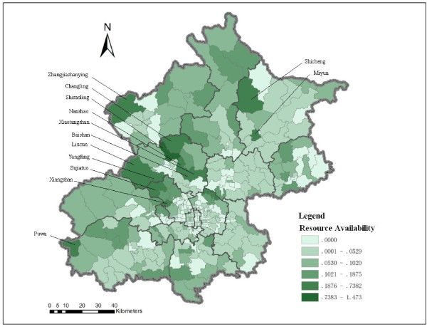
Spatial accessibility varies as the methods and considered factors change. When only time distance is considered, residential care resources are more accessible in the central city than in suburban and exurban areas. If care resources are considered in addition to time distance, spatial accessibility is relatively poor in the central city compared to the northeast to southeast side of the suburban and exurban areas. The resources in the northwest to southwest side of the city are the least accessible, even though several hotspots of residential care resources are located in these areas.
For policy making, it may require combining various methods for a comprehensive analysis. The methods used in this study provide tools for identifying underserved areas in order to improve equity in access to and efficiency in allocation of residential care resources in future planning.
随着北京市人口的快速老龄化,在市政府的支持下,养老机构行业正迅速扩张。了解老年人对养老资源的空间可达性有助于支持未来规划中对护理资源进行合理配置的需求。
本研究基于人口数据和养老资源数据,使用两种基于地理信息系统(GIS)的方法——最短路径分析和两步浮动搜索区域法(2SFCA)来分析养老资源的空间可达性。
空间可达性因方法和考虑因素的变化而有所不同。仅考虑时间距离时,养老资源在市中心比在郊区和远郊更易到达。如果将时间距离和护理资源都考虑在内,与城市东北到东南方向相比,市中心的空间可达性相对较差。城市西北到西南方向的资源可达性最差,尽管这些地区有几个养老资源热点。
对于政策制定者来说,可能需要结合各种方法进行综合分析。本研究中使用的方法为确定服务不足地区提供了工具,以便在未来规划中提高获得养老服务的公平性和资源配置效率。