Department of Ecology & Evolution, Stony Brook University, Stony Brook, New York, United States of America.
Institute for Advanced Computational Science, Stony Brook University, Stony Brook, New York, United States of America.
PLoS One. 2019 Oct 1;14(10):e0212532. doi: 10.1371/journal.pone.0212532. eCollection 2019.
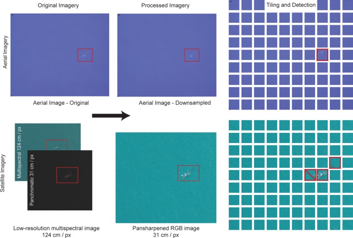
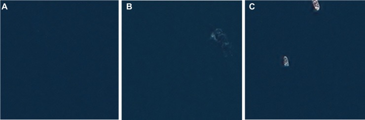
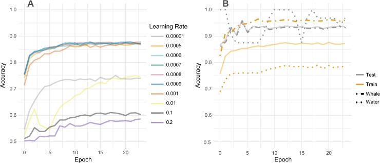
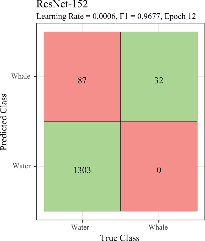
Most cetacean species are wide-ranging and highly mobile, creating significant challenges for researchers by limiting the scope of data that can be collected and leaving large areas un-surveyed. Aerial surveys have proven an effective way to locate and study cetacean movements but are costly and limited in spatial extent. Here we present a semi-automated pipeline for whale detection from very high-resolution (sub-meter) satellite imagery that makes use of a convolutional neural network (CNN). We trained ResNet, and DenseNet CNNs using down-scaled aerial imagery and tested each model on 31 cm-resolution imagery obtained from the WorldView-3 sensor. Satellite imagery was tiled and the trained algorithms were used to classify whether or not a tile was likely to contain a whale. Our best model correctly classified 100% of tiles with whales, and 94% of tiles containing only water. All model architectures performed well, with learning rate controlling performance more than architecture. While the resolution of commercially-available satellite imagery continues to make whale identification a challenging problem, our approach provides the means to efficiently eliminate areas without whales and, in doing so, greatly accelerates ocean surveys for large cetaceans.
大多数鲸目动物种类分布广泛且高度移动,这使得研究人员难以收集到足够的数据,并且有大片区域尚未被调查到,这给研究工作带来了巨大的挑战。航空调查已被证明是定位和研究鲸类动物运动的有效方法,但成本高昂且空间范围有限。在这里,我们提出了一种从超高分辨率(亚米级)卫星图像中自动检测鲸鱼的半自动化管道,该方法利用卷积神经网络(CNN)。我们使用缩小比例的航空图像对 ResNet 和 DenseNet CNN 进行了训练,并在从 WorldView-3 传感器获得的 31 厘米分辨率图像上对每个模型进行了测试。卫星图像被平铺,训练后的算法用于分类一个图像块是否可能包含鲸鱼。我们最好的模型正确分类了 100%有鲸鱼的图像块,以及 94%仅包含水的图像块。所有的模型架构都表现良好,学习率比架构更能控制性能。虽然商业卫星图像的分辨率仍使得识别鲸鱼成为一个具有挑战性的问题,但我们的方法提供了一种有效的方法,可以快速筛选出没有鲸鱼的区域,从而大大加快了对大型鲸类的海洋调查。