Department of Clinical Research and Innovation, Foch Hospital, Suresnes, France.
Front Public Health. 2022 Jan 26;10:818989. doi: 10.3389/fpubh.2022.818989. eCollection 2022.
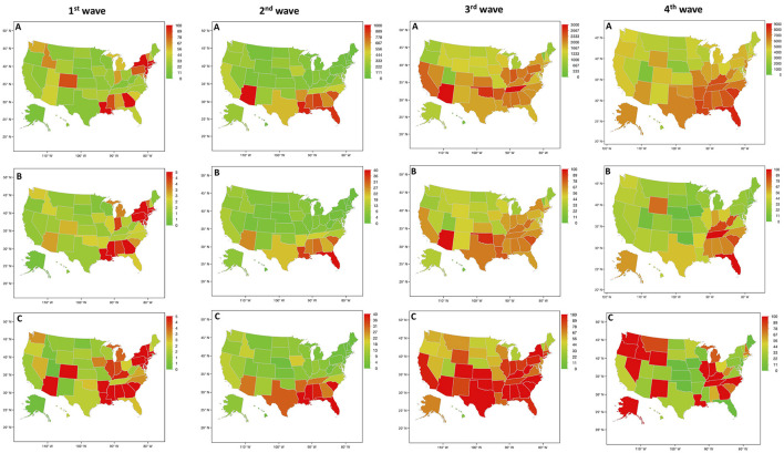
The spread of the COVID-19 pandemic has shown great heterogeneity between regions of countries, e. g., in the United States of America (USA). With the growing of the worldwide COVID-19 pandemic, there is a need to better highlight the variability in the trajectory of this disease in different worldwide geographic areas. Indeed, the epidemic trends across areas can display completely different evolution at a given time. Geo-epidemiological analyses using data, that are publicly available, could be a major topic to help governments and public administrations to implement health policies. Geo-epidemiological analyses could provide a basis for the implementation of relevant public health policies. With the COVID-19 pandemic, geo-epidemiological analyses can be readily utilized by policy interventions and USA public health authorities to highlight geographic areas of particular concern and enhance the allocation of resources.
新冠疫情的传播在各国各地区之间表现出很大的异质性,例如在美国。随着全球新冠疫情的加剧,有必要更好地突出不同全球地理区域内该疾病轨迹的可变性。实际上,在给定时间内,各地区的流行趋势可能会呈现出完全不同的演变。使用公开数据进行地理流行病学分析可能是帮助政府和公共行政部门实施卫生政策的一个主要议题。地理流行病学分析可以为实施相关公共卫生政策提供依据。在新冠疫情期间,地理流行病学分析可以通过政策干预和美国公共卫生当局的应用,突出特别关注的地理区域,并加强资源分配。