Environmental Research Group Oxford Ltd, c/o Department of Biology, Oxford, United Kingdom.
Unité Microbiologie, immunologie et maladies contagieuses, Institut Agronomique et Vétérinaire Hassan II, Rabat, Morocco.
Euro Surveill. 2023 Jun;28(26). doi: 10.2807/1560-7917.ES.2023.28.26.2200666.
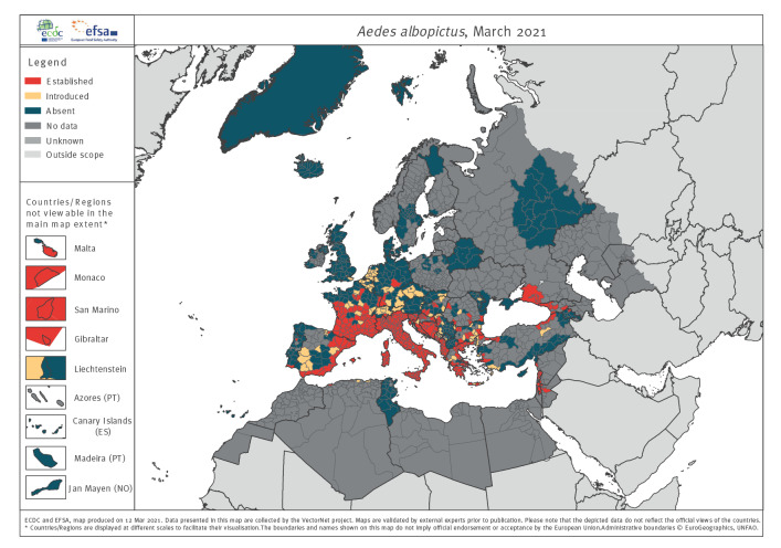
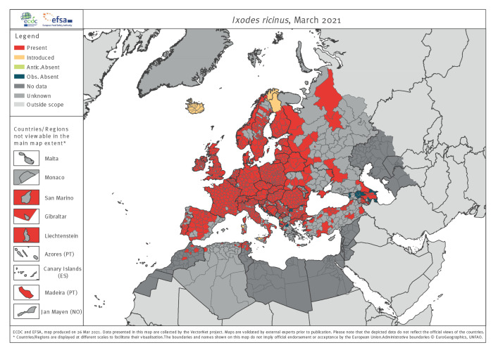
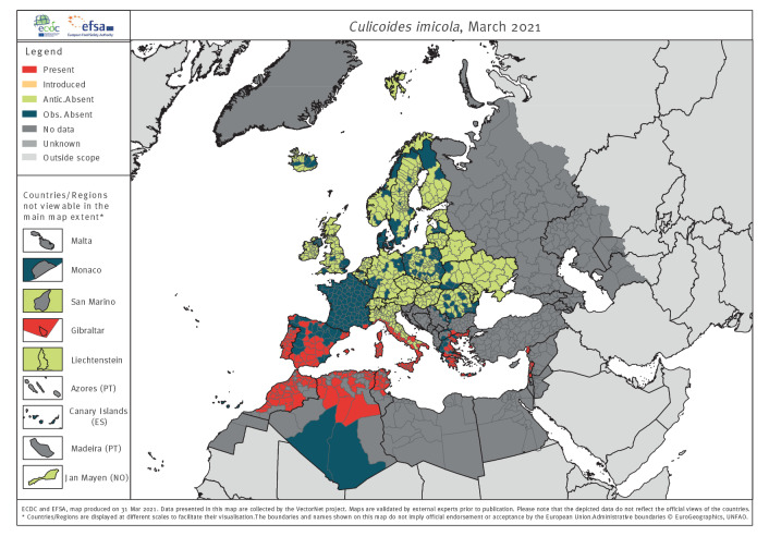
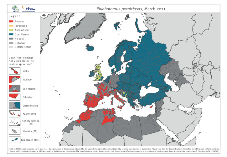
BackgroundArthropod vectors such as ticks, mosquitoes, sandflies and biting midges are of public and veterinary health significance because of the pathogens they can transmit. Understanding their distributions is a key means of assessing risk. VectorNet maps their distribution in the EU and surrounding areas.AimWe aim to describe the methodology underlying VectorNet maps, encourage standardisation and evaluate output.Methods: Vector distribution and surveillance activity data have been collected since 2010 from a combination of literature searches, field-survey data by entomologist volunteers via a network facilitated for each participating country and expert validation. Data were collated by VectorNet members and extensively validated during data entry and mapping processes.ResultsAs of 2021, the VectorNet archive consisted of ca 475,000 records relating to > 330 species. Maps for 42 species are routinely produced online at subnational administrative unit resolution. On VectorNet maps, there are relatively few areas where surveillance has been recorded but there are no distribution data. Comparison with other continental databases, namely the Global Biodiversity Information Facility and VectorBase show that VectorNet has 5-10 times as many records overall, although three species are better represented in the other databases. In addition, VectorNet maps show where species are absent. VectorNet's impact as assessed by citations (ca 60 per year) and web statistics (58,000 views) is substantial and its maps are widely used as reference material by professionals and the public.ConclusionVectorNet maps are the pre-eminent source of rigorously validated arthropod vector maps for Europe and its surrounding areas.
节肢动物媒介,如蜱、蚊子、沙蝇和吸血蠓,由于它们能够传播的病原体,对公共卫生和兽医卫生具有重要意义。了解它们的分布情况是评估风险的关键手段。VectorNet 绘制了它们在欧盟及周边地区的分布图。
我们旨在描述 VectorNet 地图背后的方法学,鼓励标准化并评估输出结果。
自 2010 年以来,VectorNet 成员通过网络收集了昆虫学家志愿者进行的实地调查数据以及文献检索,从各种渠道收集了媒介分布和监测活动数据,该网络为每个参与国家提供便利。数据由 VectorNet 成员收集,并在数据输入和绘图过程中进行了广泛验证。
截至 2021 年,VectorNet 档案包含了约 47.5 万条与 330 多种物种相关的记录。目前在线以次国家行政区分辨率制作 42 种物种的常规地图。在 VectorNet 地图上,记录的监测相对较少,但没有分布数据。与其他大陆数据库(即全球生物多样性信息设施和 VectorBase)的比较表明,总体而言,VectorNet 的记录数量是它们的 5-10 倍,尽管有三个物种在其他数据库中得到了更好的体现。此外,VectorNet 地图还显示了物种不存在的地方。VectorNet 的评估影响包括每年约 60 篇的引用和 58,000 次的网页浏览量,其地图被专业人士和公众广泛用作参考资料。
VectorNet 地图是欧洲及其周边地区经过严格验证的节肢动物媒介地图的主要来源。