Emerg Infect Dis. 2019 Jun;25(6):1118-1126. doi: 10.3201/eid2506.180392.
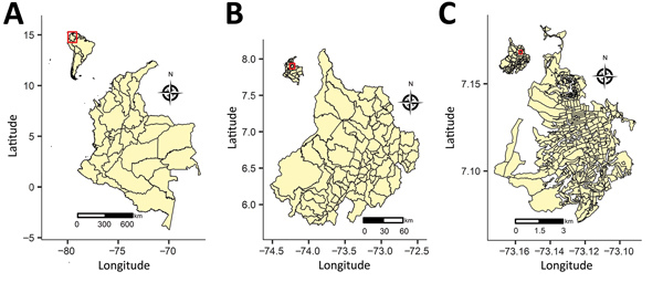
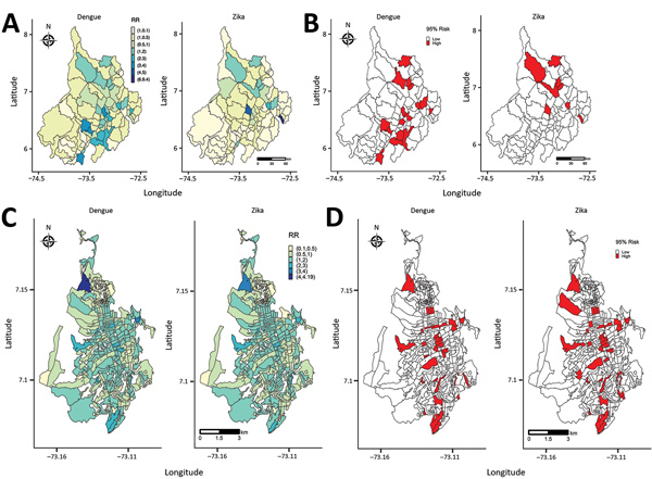
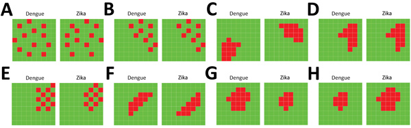
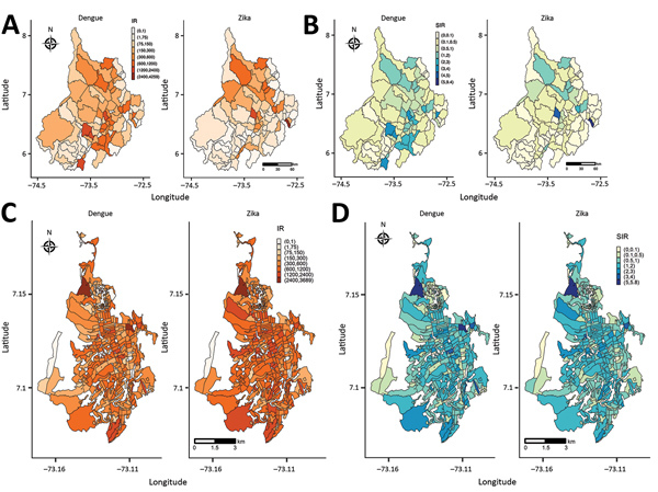
We jointly estimated relative risk for dengue and Zika virus disease (Zika) in Colombia, establishing the spatial association between them at the department and city levels for October 2015-December 2016. Cases of dengue and Zika were allocated to the 87 municipalities of 1 department and the 293 census sections of 1 city in Colombia. We fitted 8 hierarchical Bayesian Poisson joint models of relative risk for dengue and Zika, including area- and disease-specific random effects accounting for several spatial patterns of disease risk (clustered or uncorrelated heterogeneity) within and between both diseases. Most of the dengue and Zika high-risk municipalities varied in their risk distribution; those for Zika were in the northern part of the department and dengue in the southern to northeastern parts. At city level, spatially clustered patterns of dengue high-risk census sections indicated Zika high-risk areas. This information can be used to inform public health decision making.
我们联合估计了哥伦比亚登革热和寨卡病毒病(Zika)的相对风险,并在部门和城市级别上建立了它们在 2015 年 10 月至 2016 年 12 月之间的空间关联。将登革热和寨卡病例分配给哥伦比亚 1 个部门的 87 个城市和 1 个城市的 293 个普查区。我们拟合了 8 个登革热和寨卡相对风险的分层贝叶斯泊松联合模型,包括针对疾病风险的区域和疾病特异性随机效应,这些效应考虑了两种疾病内和疾病间的多种疾病风险空间模式(聚类或不相关的异质性)。大多数登革热和寨卡高风险城市在风险分布上有所不同;寨卡病毒的高风险城市位于该省北部,而登革热的高风险城市位于南部至东北部。在城市层面,登革热高风险普查区的空间聚类模式表明寨卡病毒高风险地区。这些信息可用于为公共卫生决策提供信息。