Biodiversity Research Center, Academia Sinica, Taipei, Taiwan.
Department of Organismic and Evolutionary Biology, Harvard University, Cambridge, MA, USA.
Nature. 2024 May;629(8010):114-120. doi: 10.1038/s41586-024-07264-9. Epub 2024 Mar 27.
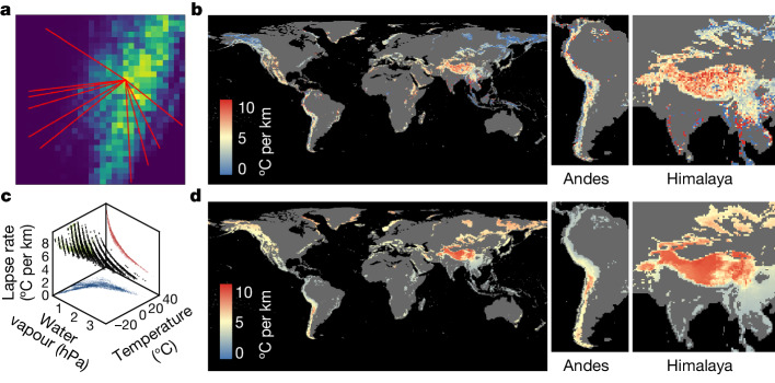
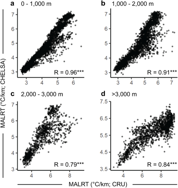
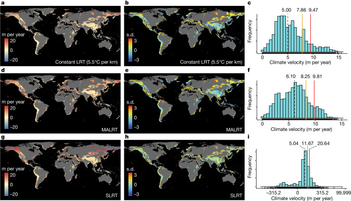
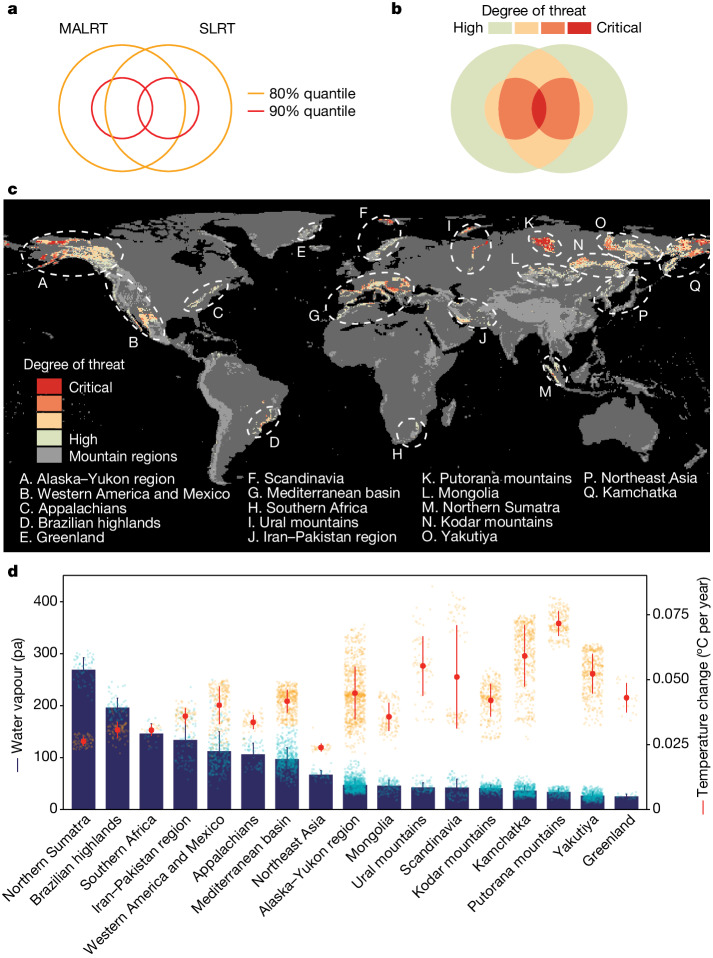
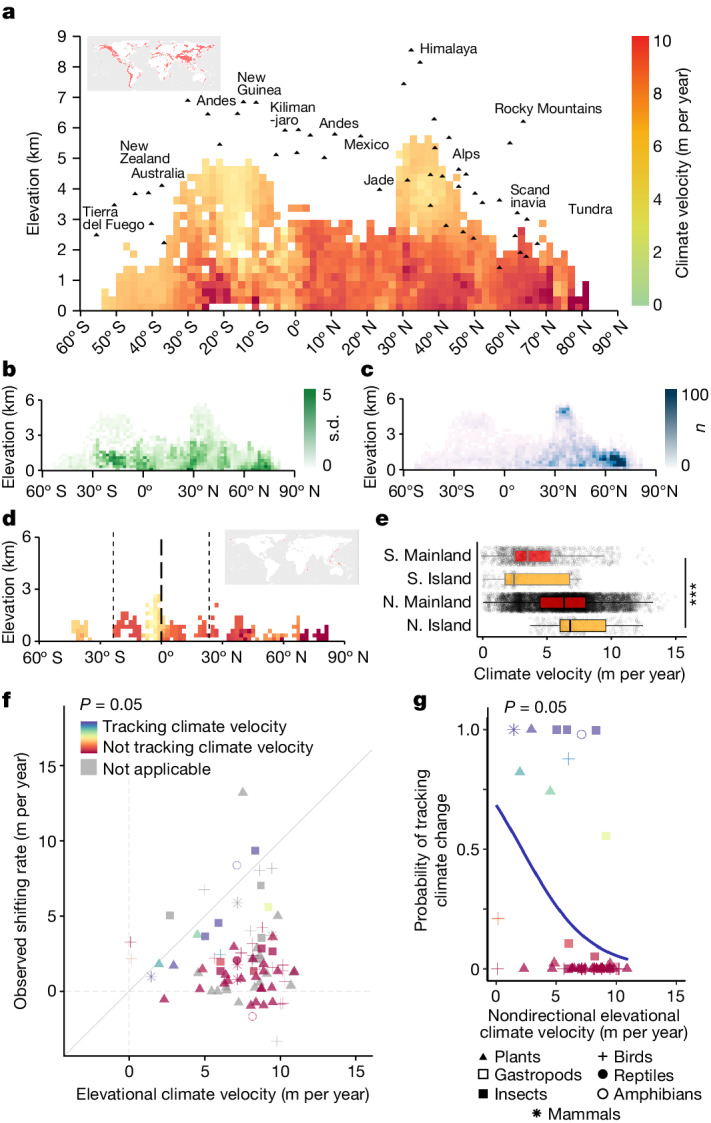
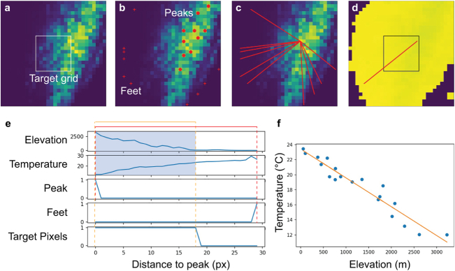
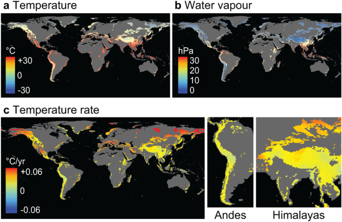
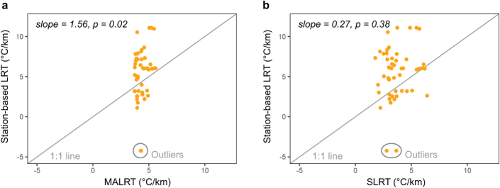
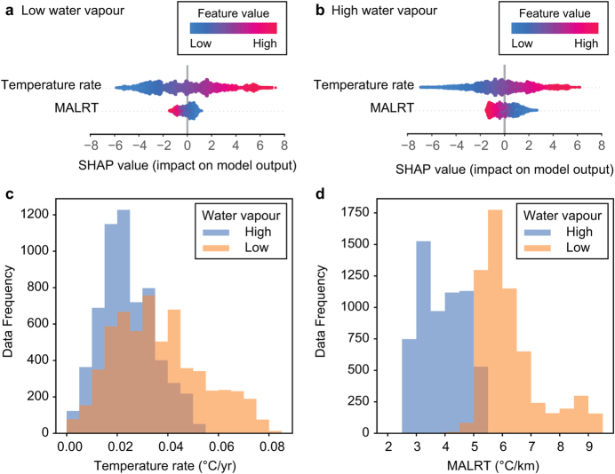
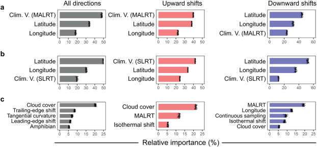
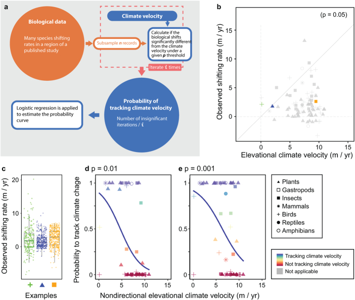
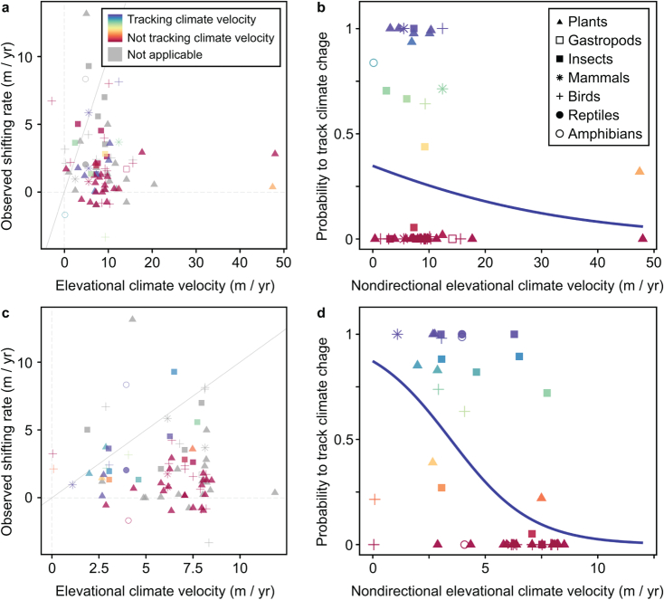
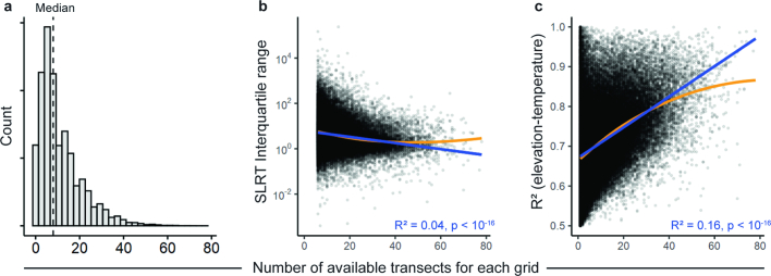
Mountain ranges contain high concentrations of endemic species and are indispensable refugia for lowland species that are facing anthropogenic climate change. Forecasting biodiversity redistribution hinges on assessing whether species can track shifting isotherms as the climate warms. However, a global analysis of the velocities of isotherm shifts along elevation gradients is hindered by the scarcity of weather stations in mountainous regions. Here we address this issue by mapping the lapse rate of temperature (LRT) across mountain regions globally, both by using satellite data (SLRT) and by using the laws of thermodynamics to account for water vapour (that is, the moist adiabatic lapse rate (MALRT)). By dividing the rate of surface warming from 1971 to 2020 by either the SLRT or the MALRT, we provide maps of vertical isotherm shift velocities. We identify 17 mountain regions with exceptionally high vertical isotherm shift velocities (greater than 11.67 m per year for the SLRT; greater than 8.25 m per year for the MALRT), predominantly in dry areas but also in wet regions with shallow lapse rates; for example, northern Sumatra, the Brazilian highlands and southern Africa. By linking these velocities to the velocities of species range shifts, we report instances of close tracking in mountains with lower climate velocities. However, many species lag behind, suggesting that range shift dynamics would persist even if we managed to curb climate-change trajectories. Our findings are key for devising global conservation strategies, particularly in the 17 high-velocity mountain regions that we have identified.
山脉集中了大量特有物种,是面临人为气候变化的低地物种不可缺少的避难所。预测生物多样性的再分布取决于评估物种是否能够随着气候变暖而追踪变化的等温线。然而,由于山区气象站稀少,对沿海拔梯度的等温线移动速度进行全球分析受到阻碍。在这里,我们通过绘制全球山区的温度递减率(LRT)图来解决这个问题,既使用卫星数据(SLRT),也使用热力学原理来考虑水蒸气(即,湿绝热递减率(MALRT))。通过将 1971 年至 2020 年的地表升温速率除以 SLRT 或 MALRT,我们提供了垂直等温线移动速度的地图。我们确定了 17 个山区的垂直等温线移动速度异常高(SLRT 大于 11.67 m/年;MALRT 大于 8.25 m/年),主要分布在干燥地区,但也分布在浅递减率的湿润地区;例如,苏门答腊北部、巴西高原和南部非洲。通过将这些速度与物种分布范围变化的速度联系起来,我们报告了在气候速度较低的山区密切跟踪的实例。然而,许多物种落后,这表明即使我们设法遏制气候变化轨迹,范围转移动态也将持续。我们的研究结果对于制定全球保护策略至关重要,特别是在我们确定的 17 个高速度山区。